Cape Cod towns and villages come in two layers. There are 15 towns, which run the beaches, set the parking rules and collect the taxes, and there are the villages inside them, which are the names you’ll actually see on signs, menus and rental listings. Hyannis, Osterville and Centerville are villages of Barnstable; Woods Hole belongs to Falmouth; Harwich Port and Dennis Port are parts of Harwich and Dennis. For a first trip, Chatham, Falmouth, Sandwich and Provincetown have the most walkable centers, Dennis and Yarmouth put you between two coasts, and Eastham and Wellfleet put you on the doorstep of the National Seashore.
This page is for choosing a base or planning day trips. The caveat that trips people up: the town, not the village, decides your beach sticker and whether visitors can park at a given beach, so check which town a rental sits in before you book. Details were checked September 23, 2026 against official sources, including the county’s own list of villages.
On this page: All 15 towns · Towns vs. villages · Which town suits you · Upper Cape · Mid Cape · Lower Cape · Outer Cape · Route 6A villages · Town vs. town · Walkability and services · Drive times · Year-round towns · FAQ
All 15 Cape Cod towns at a glance
Population figures are from the 2020 census and count year-round residents only; summer multiplies them, most dramatically on the Outer Cape.
| Town | Region | Main villages and areas | Coasts | 2020 population | Best for |
|---|---|---|---|---|---|
| Bourne | Upper | Sagamore, Monument Beach, Pocasset, Cataumet, Buzzards Bay | Buzzards Bay, the canal | 20,452 | Canal biking, a quick escape from Boston |
| Sandwich | Upper | Sandwich village, East Sandwich, Forestdale | Cape Cod Bay | 20,259 | History, museums, a walkable old center |
| Falmouth | Upper | Falmouth Village, Woods Hole, Falmouth Heights, North, West and East Falmouth | Buzzards Bay, Vineyard Sound | 32,517 | A real Main Street, bike path, Vineyard ferries |
| Mashpee | Upper | Mashpee center, New Seabury, Popponesset | Nantucket Sound | 15,060 | Resort stays, golf, Wampanoag culture |
| Barnstable | Mid | Hyannis, Centerville, Osterville, Cotuit, Marstons Mills, West Barnstable, Barnstable Village | Cape Cod Bay, Nantucket Sound | 48,916 | Ferries, services, the most choice |
| Yarmouth | Mid | Yarmouth Port, South Yarmouth, Bass River, West Yarmouth | Bay and Sound | 25,023 | Budget stays, historic Route 6A |
| Dennis | Mid | Dennis Village, East Dennis, South Dennis, West Dennis, Dennis Port | Bay and Sound | 14,674 | Families who want both coasts |
| Brewster | Lower | Brewster, East and West Brewster | Cape Cod Bay | 10,318 | Tidal flats, camping, the Rail Trail |
| Harwich | Lower | Harwich Port, Harwich Center, East, North, South and West Harwich, Pleasant Lake | Nantucket Sound, Pleasant Bay | 13,440 | Warm beaches, harbor life |
| Chatham | Lower | Chatham, North, South and West Chatham | Sound, Atlantic, Pleasant Bay | 6,594 | A classic Main Street, seals |
| Orleans | Lower | Orleans, East Orleans, South Orleans | Bay, Atlantic, Pleasant Bay | 6,307 | Supplies and sunsets on the way out |
| Eastham | Outer | Eastham, North Eastham | Bay and Atlantic | 5,752 | Seashore beaches, cottages |
| Wellfleet | Outer | Wellfleet, South Wellfleet | Bay and Atlantic | 3,566 | Oysters, galleries, ocean beaches |
| Truro | Outer | Truro, North Truro | Bay and Atlantic | 2,454 | Dunes, quiet, dark skies |
| Provincetown | Outer | No villages; the West End and East End | Harbor and Atlantic | 3,664 | Nightlife, art, a car-free stay |
How do Cape Cod’s towns and villages work?
Cape Cod and Barnstable County are the same place: 15 towns, usually grouped into four regions. The Upper Cape is Bourne, Sandwich, Falmouth and Mashpee; the Mid Cape is Barnstable, Yarmouth and Dennis; the Lower Cape is Brewster, Harwich, Chatham and Orleans; and the Outer Cape is Eastham, Wellfleet, Truro and Provincetown. The names confuse newcomers, because the Lower Cape is farther from the mainland than the Upper Cape. The usual explanation is longitude, whose numbers drop as you travel east, the way sailors went “down east.”
Villages are communities with their own history, post offices and personality, but not their own governments. That matters in three practical ways. Beach stickers and parking rules come from the town, so a rental in Hyannis means Barnstable’s rules. Addresses use village names, so listings in Osterville and Hyannis can be a short drive apart and a world apart in feel. And a few places aren’t on the side of the canal you’d expect: Bourne’s Buzzards Bay and Sagamore Beach, and a corner of Sandwich, sit on the mainland side of the Cape Cod Canal.
The county’s Registry of Deeds keeps the official list of village names by town, and it’s longer than most visitors guess. Barnstable alone adds Hyannis Port, Craigville, Cummaquid, Wianno and Santuit to its seven main villages, while Provincetown has no villages at all. For the bigger picture of how the Cape’s regions shape a trip, start with our complete guide to planning a Cape Cod trip.
Which Cape Cod town suits your trip?
Start with how you want to spend your days, then find the town that makes that easy.
| If you want | Look at | Why |
|---|---|---|
| A village you can walk after dinner | Chatham, Falmouth, Sandwich, Provincetown | Real Main Streets with shops and restaurants |
| Both coasts within minutes | Dennis, Yarmouth, Barnstable | Bay beaches on one side, Sound beaches on the other |
| The National Seashore on your doorstep | Eastham, Wellfleet, Truro | Ocean beaches, trails and dark skies |
| Nightlife | Provincetown, then Hyannis | The only two places that stay up late |
| A car-free trip | Provincetown, Falmouth and Woods Hole, Hyannis | Ferries, buses and compact centers |
| Lower-cost stays | Yarmouth, Hyannis, Dennis Port, West Dennis | Motels and cottage colonies along Route 28 |
| Quiet and upscale | Osterville, Chatham, Orleans | Harbors, big houses and very little neon |
| The shortest drive from Boston | Sandwich, Bourne, Falmouth | Minutes from the bridges |
| Young kids | Dennis, Brewster, Harwich, Eastham | Calm beaches, bike paths and cottage rentals |
If beaches are the deciding factor, compare the coasts in our guide to the best beaches on Cape Cod; each town’s shoreline faces different water, and it shapes the whole feel of a stay.
Upper Cape towns: Bourne, Sandwich, Falmouth and Mashpee
The Upper Cape is closest to the bridges and the most suburban part of the Cape, with warm Buzzards Bay and Sound water, the Martha’s Vineyard ferries and the shortest drives from Boston. It’s also the part most visitors drive straight through, which is often a mistake.
Bourne
Bourne is the Cape’s front door: both bridges land in it, and the canal runs through the middle. Buzzards Bay village and Sagamore Beach sit on the mainland side, along with Massachusetts Maritime Academy, while on the Cape side Monument Beach, Pocasset and Cataumet are quiet Buzzards Bay villages of shingled houses and small beaches. For visitors, Bourne mostly means the canal, whose flat, paved service roads on both banks are among the best easy rides on the Cape, with ships sliding past. The Aptucxet Trading Post Museum recreates a 1627 Plymouth Colony trading post, and the summer CapeFLYER train stops at both Buzzards Bay and Bourne. Think twice if you want a vacation-town feel; Bourne is more a place people live than a place they visit.
Sandwich
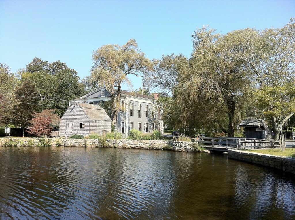
Sandwich, settled in 1637, is the oldest town on the Cape and the best-preserved first impression of it. The village center wraps around Shawme Pond, with the Dexter Grist Mill, the Hoxie House (one of the Cape’s oldest houses), the Sandwich Glass Museum and, just outside the center, Heritage Museums & Gardens. A boardwalk crosses the marsh to Town Neck Beach on Cape Cod Bay. Route 6A, the Old King’s Highway, starts here and runs east through the Cape’s best-kept historic villages. Because it’s minutes from the Sagamore Bridge, Sandwich works for a short trip or a first night. The trade-offs are bay beaches only and very little nightlife.
Falmouth
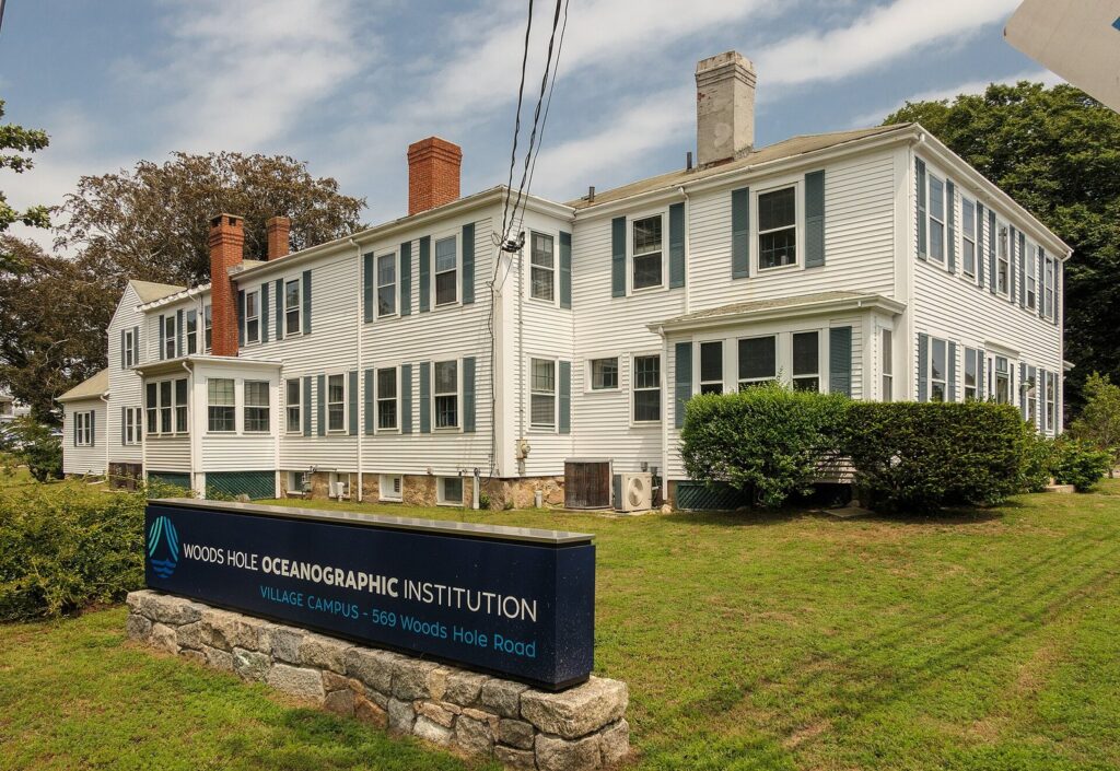
Falmouth, the Cape’s second-largest town, is really several places. Falmouth Village has a proper Main Street and a town green. Falmouth Heights is a hillside of summer houses above a Sound beach. North and West Falmouth are quieter Buzzards Bay villages near Old Silver Beach. And Woods Hole, at the southwest corner, is a working science village, home to the Woods Hole Oceanographic Institution, the Marine Biological Laboratory and NOAA’s fisheries science center, as well as the port for the Martha’s Vineyard ferries. The 10.7-mile Shining Sea Bikeway ties the villages together, and Peter Pan buses run from Logan Airport to Woods Hole with a Falmouth stop. Falmouth also has one of the Cape’s two hospitals. Best for: a car-light stay with a real downtown and island day trips.
Mashpee
Mashpee is home to the Mashpee Wampanoag Tribe, whose government is based here. The Wampanoag, the People of the First Light, have lived on this land for thousands of years and still do, and the tribe’s powwow, held around the Fourth of July (the 105th ran July 3 to 5, 2026), is one of the Cape’s major cultural events; check the tribe’s own website for dates and visitor etiquette. For visitors, the town splits between Mashpee Commons, a walkable shopping and dining district built as a new town center, and the resort and golf communities of New Seabury and Popponesset on Nantucket Sound. South Cape Beach State Park and the Waquoit Bay reserve give it a quieter, wilder shoreline. Best for: families who want a resort-style base and warm water.
Mid Cape towns: Barnstable, Yarmouth and Dennis
The Mid Cape is the Cape’s center of gravity: the biggest town, the airport, the Nantucket ferries, the most shops and motels, and both coasts within a few minutes of each other.
Barnstable
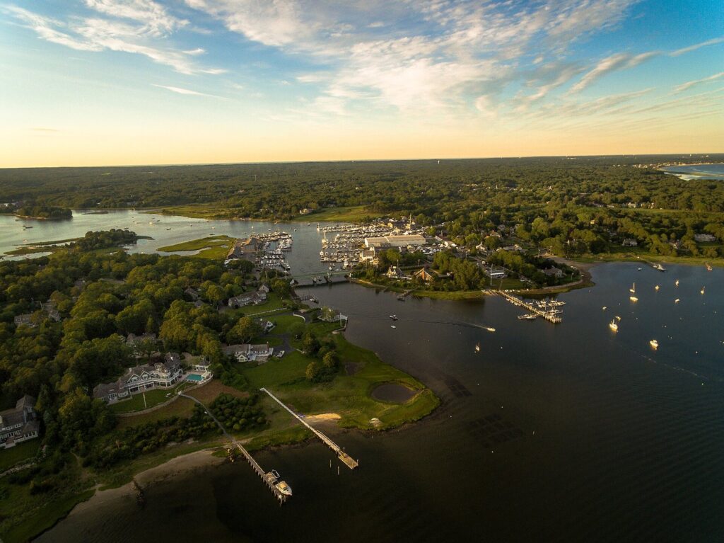
Barnstable is the largest town on the Cape by far, with 48,916 people in 2020, and it makes most sense as seven villages. Hyannis is the commercial hub: the Nantucket ferries run by the Steamship Authority and Hy-Line, the transportation center where buses and the summer CapeFLYER train stop, the airport, Cape Cod Hospital, the JFK Hyannis Museum and a walkable Main Street that leads down to the harbor. Osterville is polished and quiet, with big houses on the water. Centerville has Craigville Beach. Cotuit is a small harbor village with the Cahoon Museum of American Art, and Marstons Mills is inland pond country. On the bay side, Barnstable Village and West Barnstable run along Route 6A, with Barnstable Harbor and Sandy Neck. Best for: a practical base with everything nearby. Think twice if you picture a sleepy village when you book “Hyannis”; it’s busy and commercial by design.
Yarmouth
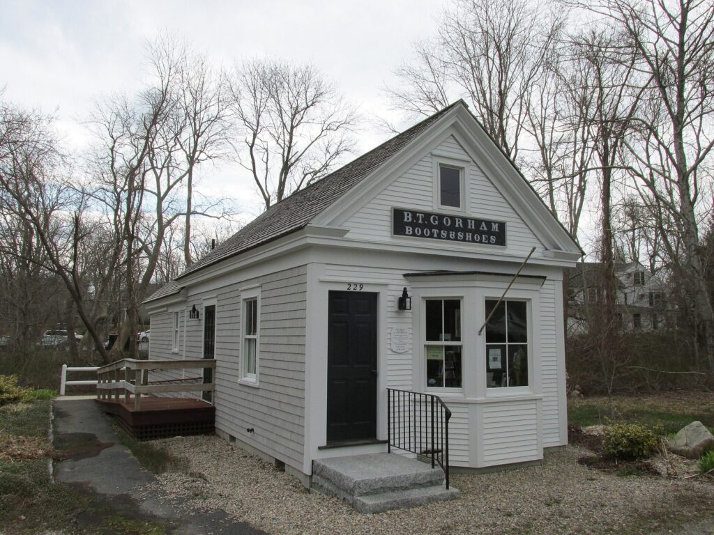
Yarmouth, the Cape’s third-largest town, has three personalities. Yarmouth Port, on the bay side along Route 6A, is sea captains’ houses, the Edward Gorey House and the Bass Hole Boardwalk over the marsh. South Yarmouth and Bass River are quieter and built around the river. West Yarmouth is Route 28’s strip of motels, mini golf and the Whydah Pirate Museum. That spread makes Yarmouth one of the easier places to find a lower-cost room, with Nantucket Sound beaches such as Seagull on the south side. Best for: families watching costs. Think twice if you want a walkable center; Yarmouth’s are either small or strung along a highway.
Dennis
Dennis may be the best all-round family base on the Cape, because the town stretches from bay to Sound: Mayflower and Corporation beaches on one side and West Dennis Beach on the other are both close. Dennis Village on Route 6A has the Cape Playhouse, staging summer theater since 1927, together with the Cape Cinema and the Cape Cod Museum of Art on one campus, plus Scargo Tower above Scargo Lake. Dennis Port and West Dennis on the south side are cottage-and-clam-shack country, and the Cape Cod Rail Trail’s main trailhead is in South Dennis. Best for: families who want both kinds of beach without much driving.
Lower Cape towns: Brewster, Harwich, Chatham and Orleans
The Lower Cape is where the Cape starts to look like the postcards: tidal flats, shingled villages, Pleasant Bay and, at Chatham and Orleans, the first taste of the open Atlantic.
Brewster
Brewster is Cape Cod Bay’s town. All of its beaches sit on the flats, and at low tide the water retreats a remarkably long way. There’s no real downtown, just Route 6A lined with old houses, inns, antiques and a general store, which suits the town’s quiet, outdoorsy crowd. Nickerson State Park has kettle ponds, trails and a campground, and the Rail Trail runs straight through town. The Cape Cod Museum of Natural History and the Stony Brook Grist Mill, where herring run up the brook in spring, round it out. Best for: families with young children, campers and cyclists. Think twice if you want surf or nightlife.
Harwich
Harwich faces Nantucket Sound, so its beaches, Red River among them, are warm and gentle, and Harwich Port has a short, walkable stretch of shops and restaurants along Route 28. Saquatucket and Wychmere harbors give it a working-waterfront feel, and the town’s cranberry bogs are a reminder of what paid the bills before tourism did. East Harwich reaches Pleasant Bay, and the Cape League’s Harwich team hosted the 2026 All-Star Game. Best for: families who want warm water and a calmer base between Dennis and Chatham.
Chatham
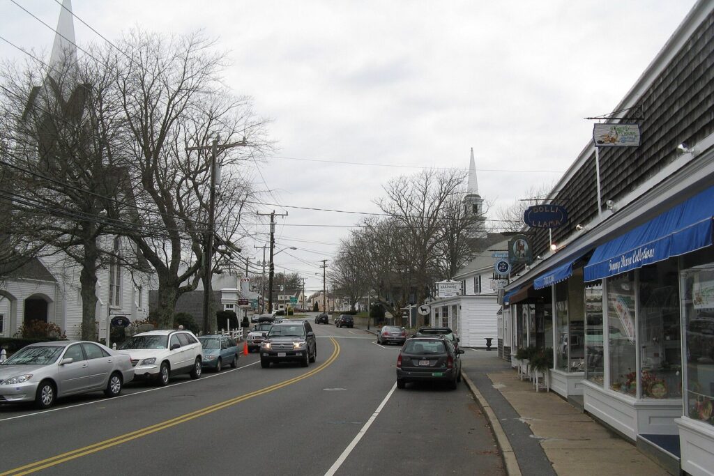
Chatham is the Cape’s classic village: a Main Street of shops, galleries and inns you can walk end to end, Chatham Light above the harbor inlet, the Fish Pier, and gray seals by the hundreds off Monomoy. It touches three bodies of water, Nantucket Sound, the Atlantic and Pleasant Bay, and on summer Friday nights the free Chatham Band concert fills Kate Gould Park. It’s also one of the most expensive places to stay on the Cape, and its roads clog in July. Best for: couples and anyone who wants to walk to dinner. Think twice if you’re on a tight budget or hate traffic.
Orleans
Orleans is the hinge of the Cape. Route 6A and Route 28 both end here, and everything bound for the Outer Cape funnels onto Route 6 at the rotary, so Orleans is where the Lower Cape shops for groceries and hardware. It also has two very different beaches: Skaket on the bay, with its sunset flats, and Nauset on the Atlantic, both $35 a day to park in 2026. Rock Harbor, home to a charter fishing fleet, is an evening ritual, and Pleasant Bay is a paddler’s playground. Best for: a base that reaches both the Lower and Outer Cape. Think twice if you want a strollable village; the center is compact but built around the car.
Outer Cape towns: Eastham, Wellfleet, Truro and Provincetown
The Outer Cape is National Seashore country: ocean beaches, dunes, kettle ponds and small towns that swell in summer and go very quiet in winter. It’s also where the Cape grew fastest between 2010 and 2020, with Wellfleet up about 30%, Provincetown 25% and Truro 23%.
Eastham
Eastham is the Seashore’s front door. Salt Pond Visitor Center, open year-round, Fort Hill, Coast Guard Beach and Nauset Light Beach are all here, along with First Encounter Beach on the bay, named for the December 1620 clash between the Mayflower’s scouting party and the Nauset people. There’s no real village center, mostly cottages, motels and clam shacks along Route 6, which is why the town appeals to families who spend every day outdoors. The Rail Trail passes through and links to the Seashore’s Nauset Bike Trail. Best for: beach-first families. Think twice if you want shops within walking distance.
Wellfleet
Wellfleet packs the Outer Cape into one small town: the oysters that made its name, a compact center of galleries and restaurants above the town pier, ocean beaches under tall dunes, the Wellfleet Drive-In and its flea market, and Mass Audubon’s Wellfleet Bay Wildlife Sanctuary. It grew faster than any other Cape town between 2010 and 2020, yet it still feels like a place where the harbor matters more than the shops. OysterFest takes over the center in mid-October. Best for: food lovers and beach walkers. Think twice if you’re visiting in winter and need restaurants; many close for the season.
Truro
Truro, with 2,454 people in 2020, is the Cape’s smallest town and its emptiest-feeling. Much of it is National Seashore: Highland Light above the ocean cliffs, Head of the Meadow Beach, the Pamet River valley and bay beaches such as Corn Hill. North Truro’s cottage colonies line Route 6A along the bay with views across to Provincetown. There’s no downtown to speak of, and that’s the point: Truro is for people who want dunes, dark skies and a quiet porch, with Provincetown’s restaurants a short drive away.
Provincetown
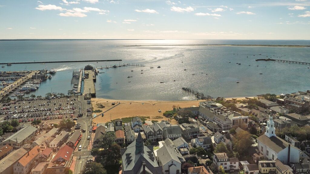
Provincetown, at the tip, is the Cape’s most distinctive town: a historic fishing port, one of the country’s oldest art colonies, a center of LGBTQ+ life and culture, and the place where the Mayflower first anchored in 1620. Its 3,664 year-round residents are joined by a much larger summer crowd, and Commercial Street, about three miles long, is the whole show: galleries, guesthouses, restaurants, cabaret and drag, and whale-watch boats at MacMillan Pier. It’s also the one Cape town you can reach and enjoy without a car. Bay State Cruise Company’s fast ferry from Boston takes about 95 minutes and ran daily from May 16 to October 18 in 2026; Cape Air flies from Boston; Peter Pan buses run from Boston, Logan and Hyannis; and the free CCRTA Provincetown Shuttle covers the town. Best for: nightlife, art and a car-free week. Think twice if you want a quiet family week in August, when the town is packed.
The Old King’s Highway: Route 6A’s historic villages
If you want the Cape of sea captains’ houses, white churches and antique shops, drive Route 6A, the Old King’s Highway, instead of Route 6. It follows the bay side from Sandwich through Barnstable Village, Yarmouth Port, Dennis and Brewster to Orleans, and a regional historic district protects much of the corridor, which is why it still looks the way it does. Go slowly. It’s a two-lane country road with cyclists, stone walls and driveways tucked behind hedges, and it takes far longer than the highway. That’s the point. Stop at Sandwich village, the Bass Hole Boardwalk in Yarmouth Port, the Cape Playhouse campus in Dennis and the Stony Brook Grist Mill in Brewster, and you’ll have seen the best of the old Cape in a single unhurried day.
Choosing between two similar towns
Most people narrow the list to two. These are the pairs that come up most often, and the honest differences between them.
Chatham or Orleans?
Chatham is the better village: a Main Street you’ll walk every evening, the lighthouse, the Fish Pier and the seals. Orleans is the better base, with the big grocery stores, bay and ocean beaches a short drive apart and a head start on the Outer Cape. Choose Chatham for a trip built around strolling and long dinners. Choose Orleans if your days are beaches in Eastham, sunsets at Skaket and the odd run up to Provincetown.
Falmouth or Hyannis?
Both are service towns with ferries, hospitals and real downtowns. Falmouth is prettier and calmer, with the Shining Sea Bikeway, Woods Hole and the Vineyard ferries, and it’s closer to the bridges. Hyannis is more central, with the Nantucket ferries, the airport, more motels and the CapeFLYER, and it’s a better jumping-off point for the Lower and Outer Cape. Pick Falmouth for a slower Upper Cape week with a Vineyard day; pick Hyannis if you’ll be driving all over the Cape.
Dennis or Yarmouth?
These neighbors share the same geography, bay to Sound, and much of the same cottage-and-motel stock on Route 28. Dennis has the edge on beaches, with Mayflower and West Dennis, and on culture, with the Cape Playhouse campus, and the Rail Trail starts there. Yarmouth’s stretch of Route 28 has a longer run of motels and kid attractions, including mini golf and the Whydah Pirate Museum. For a family week both work, but Dennis feels a little more like a beach town.
Eastham or Wellfleet?
Both put you beside the National Seashore. Eastham is flatter and more practical, with the Seashore’s year-round visitor center, Coast Guard Beach, the Rail Trail and cottages that suit families. Wellfleet has more personality: the harbor, the oysters, the galleries, the drive-in and the most dramatic ocean beaches on the Cape, under tall dunes. Families with young kids tend to prefer Eastham, while couples and food lovers lean toward Wellfleet.
Provincetown or Truro?
Provincetown is for being in the middle of things: restaurants, shows, galleries and a crowd, all within walking distance. Truro gives you all of that a short drive away while you sleep somewhere silent, among dunes and bay-side cottages. If you want nightlife every night, stay in town. If you want it twice a week, North Truro is the smart compromise.
Where can you walk to dinner, and where do you need a car?
Only a handful of places let you park the car for days: Provincetown’s Commercial Street, Chatham’s Main Street, Falmouth Village and Woods Hole, Hyannis’s Main Street and harbor, Sandwich village around Shawme Pond, and, on a smaller scale, Wellfleet center, Harwich Port and Mashpee Commons. Everywhere else, “walkable” means walkable to the beach, and you’ll drive for groceries and dinner.
Services follow population. The Cape’s two hospitals are in Hyannis and Falmouth. The big supermarkets and chain stores cluster in Hyannis along Route 132, in Falmouth, and in Orleans, which serves the Lower and Outer Cape; by Truro, a big grocery run means a drive to Orleans or Provincetown. Summer adds hours and shuttles, and winter takes them away, especially on the Outer Cape, where many restaurants close from late fall to spring.
How far is each town from the bridges?
Every road onto the Cape crosses the canal on the Sagamore or Bourne Bridge, so distance from the bridges is the real measure of how much driving a base will cost you. Clear-road times from the Sagamore Bridge:
| Region | Towns | Clear-road drive from the Sagamore Bridge | Summer reality |
|---|---|---|---|
| Upper Cape | Bourne, Sandwich, Falmouth, Mashpee | Minutes to about half an hour; Falmouth is quicker via the Bourne Bridge | Short drives, but the bridge approaches back up on Friday afternoons and Saturdays |
| Mid Cape | Barnstable, Yarmouth, Dennis | About 25 to 30 minutes to Hyannis | Route 132 and Route 28 crawl in the afternoon |
| Lower Cape | Brewster, Harwich, Chatham, Orleans | About 45 to 50 minutes to Chatham | Route 6 toward Orleans is the bottleneck |
| Outer Cape | Eastham, Wellfleet, Truro, Provincetown | About 1 hour 15 minutes to Provincetown | Past Orleans there’s one main road, and the slowest car sets the pace |
Add about an hour from Boston to the Sagamore Bridge with clear roads, and a good deal more on a summer Friday. Traditional Cape rentals run Saturday to Saturday, which makes Saturday the worst day on the bridges; if you can arrive midweek, or cross before mid-morning, the whole trip starts better.
Which towns are lively year-round?
The Cape had 228,996 year-round residents in the 2020 census, and summer estimates run well past 400,000 before you count day visitors. Hyannis, Falmouth, Sandwich, Yarmouth and Mashpee feel most like ordinary towns in winter, with open restaurants and full services. The Outer Cape empties out: Provincetown, Wellfleet and Truro together had fewer than 10,000 residents in 2020, though all three grew by more than 20% over the decade before. In 2020 the county also posted the fourth-highest in-migration in the country, by the Postal Service’s count, and Sandwich was the only Cape town to lose residents. If you’re coming between November and April, base yourself in Hyannis, Falmouth or Orleans and day-trip outward, or choose Provincetown for a quiet week with a short list of good restaurants still open. For ideas on how to fill the days once you’ve picked a town, see the best things to do on Cape Cod.
Cape Cod Towns and Villages FAQ
How many towns are on Cape Cod?
Fifteen: Bourne, Sandwich, Falmouth, Mashpee, Barnstable, Yarmouth, Dennis, Brewster, Harwich, Chatham, Orleans, Eastham, Wellfleet, Truro and Provincetown. Together they make up Barnstable County. Martha’s Vineyard and Nantucket are separate counties and not part of Cape Cod, and places such as Hyannis and Woods Hole are villages within towns, not towns of their own.
What’s the difference between a town and a village on Cape Cod?
A town is the municipality: it runs the beaches, sells the parking stickers, sets local rules and collects taxes. A village is a named community inside a town, often with its own post office and character but no separate government. Hyannis, for example, is a village of Barnstable, so Barnstable’s beach rules apply there.
Is Hyannis a town?
No. Hyannis is the largest of Barnstable’s seven villages and the Cape’s commercial hub, with the Nantucket ferries, the airport, Cape Cod Hospital, the main bus and train stop and the JFK Hyannis Museum. Its beaches, such as Kalmus and Veterans, are Barnstable town beaches, so Barnstable’s stickers and daily parking rules apply.
What is the prettiest town on Cape Cod?
Chatham usually wins the vote for its Main Street, lighthouse and harbor. Sandwich village around Shawme Pond, Yarmouth Port and Dennis along Route 6A, Wellfleet’s harbor and Osterville are close behind. For raw scenery rather than villages, Truro and the Outer Cape’s National Seashore have no equal on the Cape.
Which Cape Cod town is best for families?
Dennis is the strongest all-rounder, with calm bay beaches, warm Sound beaches and the Rail Trail all close. Brewster suits families with toddlers who love the tidal flats, Harwich offers warm water and a quieter base, and Eastham puts beach-first families beside the National Seashore. Yarmouth is the pick for families watching costs.
Which Cape Cod town is best without a car?
Provincetown, by a wide margin: fast ferries from Boston in season, Cape Air flights, buses, a walkable main street and a free town shuttle. Falmouth and Woods Hole come next, with the Shining Sea Bikeway and buses from Logan, followed by Hyannis, where the summer CapeFLYER train, buses and ferries meet.
Related Cape Cod Guides
- Best Beaches in Cape Cod: which coast each town faces, and the 12 beaches worth planning around
- Best Things to Do in Cape Cod: the top activities, sorted by region, weather and budget
- Cape Cod Travel Guide: getting here, when to come and how long to stay
Sources and verification
The details on this page were checked on September 23, 2026 against the agencies, towns and operators listed below. The guide is compiled from those sources and claims no first-hand visits.
- Barnstable County Registry of Deeds: villages of Cape Cod
- Cape Cod Commission: 2020 census results
- Barnstable County: geography and population
- Data Cape Cod: year-round population
- Cape Cod Commission
- Mashpee Wampanoag Tribe
- Cape Cod National Seashore: visitor centers
- Town of Orleans: beach parking fees
- CapeFLYER
- Steamship Authority
- Hy-Line Cruises
- Bay State Cruise Company
- Cape Air
- Peter Pan Bus Lines
- Cape Cod Regional Transit Authority
Cape Cod Tourism Guide is an independent publication, not affiliated with the Cape Cod Chamber of Commerce, the National Park Service or any business named here.
Photo credits
- West Bay, Osterville: photo by Parkerjh, Wikimedia Commons (CC BY-SA 4.0)
- Shawme Pond, Sandwich: photo by Andrewrabbott, Wikimedia Commons (CC BY-SA 3.0)
- Woods Hole Oceanographic Institution village campus: photo by Kenneth C. Zirkel, Wikimedia Commons (CC BY-SA 4.0)
- Historical Society of Old Yarmouth, Yarmouth Port: photo by John Phelan, Wikimedia Commons (CC BY 4.0)
- Main Street, Chatham: photo by John Phelan, Wikimedia Commons (CC BY 3.0)
- Provincetown from the Pilgrim Monument: photo by RoySmith, Wikimedia Commons (CC BY-SA 4.0)