Cape Cod transportation starts with one fact: every road onto the Cape crosses the Cape Cod Canal on the Sagamore or Bourne Bridge, so most visitors drive. You don’t have to, though. The CapeFLYER train runs from Boston to Hyannis on summer weekends for $22 one way, buses run daily from Boston and Logan Airport to Hyannis, Woods Hole and Provincetown, fast ferries cross from Boston to Provincetown in season, and small planes fly to Provincetown and Hyannis. Once you’re here, every CCRTA fixed-route bus is fare-free, and bike paths cover some of the best miles.
This page is for planning the trip door to door: which way to come, what it costs, when the bridges jam, and how to get around once you arrive, with or without a car. The caveat is seasonality. Trains, ferries, shuttles and many flights run only in summer or on reduced winter schedules, so check dates before you build a plan around them. Schedules and fares were checked September 23, 2026 against the operators and agencies listed below.
On this page: Options compared · Driving · The bridges · Without a car · Flying · Getting around · By region · Bikes on transit · Costs compared · Door-to-door plans · Island ferries · Traffic timing · Parking · Off-season travel · FAQ
How to get to Cape Cod: every option compared
The right choice depends on where you’re starting, where you’re staying and whether you want a car once you arrive.
| Option | From | To | Time | 2026 cost | Season |
|---|---|---|---|---|---|
| Car | Boston | Sagamore Bridge | About 1 hour on clear roads | Gas and parking | All year |
| CapeFLYER train | Boston South Station | Hyannis, with stops at Buzzards Bay and Bourne | See the schedule | $22 one way, $40 round trip | Fridays to Sundays, Memorial Day to Labor Day |
| Plymouth & Brockton bus | South Station and Logan | Hyannis; Woods Hole | See the schedule | Check the operator | Daily, except three major holidays |
| Peter Pan bus | Logan and Boston | Woods Hole via Falmouth; Provincetown | See the schedule | Check the operator | Daily |
| Fast ferry | Boston | Provincetown | About 95 minutes (Bay State Cruise Company) | $128 adult round trip | Daily May 16 to October 18, then weekends to November 15 |
| Fast ferry | Plymouth | Provincetown | 90 minutes (Captain John Boats) | $59 weekday, $69 weekend round trip | Summer season |
| Cape Air | Boston Logan | Provincetown | A short hop | Check the airline | Daily May 14 to November 2; reduced winter schedule |
| JetBlue | New York JFK | Hyannis | A short flight | Check the airline | Daily in summer, from June 25 in 2026 |
Driving to Cape Cod
Driving is the most flexible way to see the Cape, and for most of it, the only practical one. There are two ways across the canal:
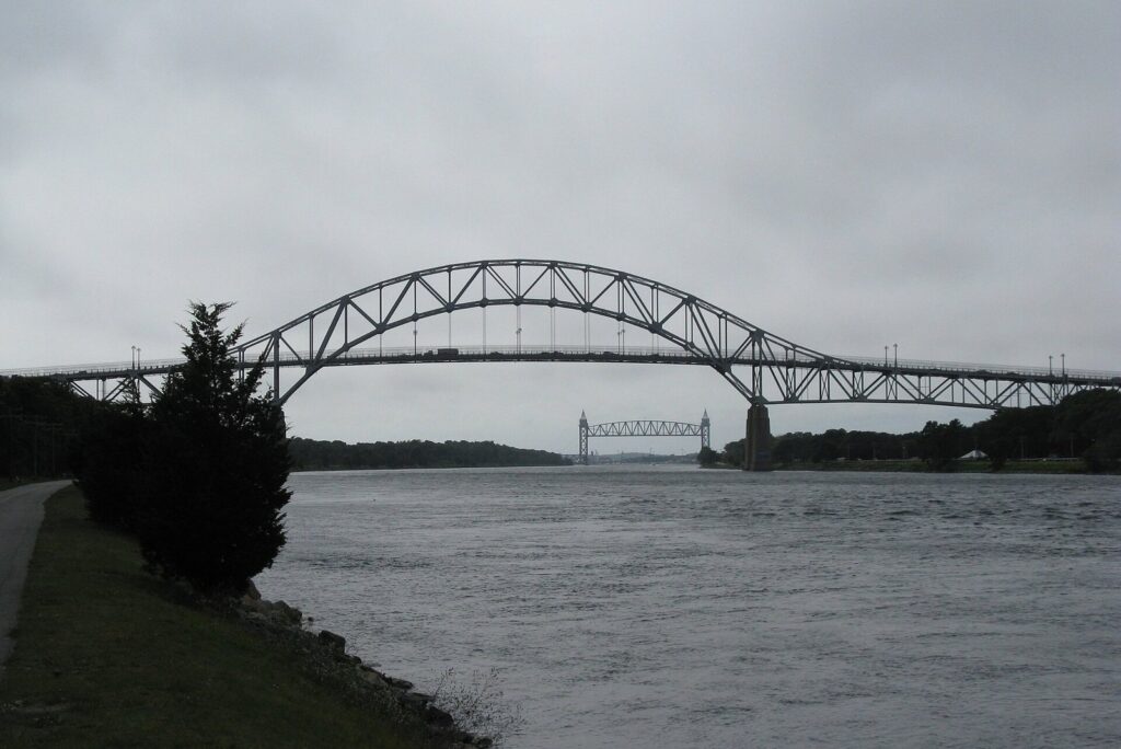
- The Sagamore Bridge carries Route 6, the Mid-Cape Highway, and is the natural crossing from Boston and the South Shore via Route 3. Take it for Sandwich, the Mid Cape, the Lower Cape and the Outer Cape.
- The Bourne Bridge carries Route 28 and connects to Route 25, which links to I-495 and I-195. It’s the natural crossing from Providence, Connecticut, New York and western Massachusetts, and the quicker way to Falmouth, Woods Hole and Mashpee.
With clear roads, Boston to the Sagamore Bridge takes about an hour. From the Sagamore Bridge it’s about 25 to 30 minutes to Hyannis, 45 to 50 minutes to Chatham and 1 hour 15 minutes to Provincetown, about 63 miles away. Those numbers can double in summer. Route 6 is a four-lane highway as far as Dennis, then narrows to one lane each way toward Orleans, where it meets the rotary and continues to Provincetown with long single-lane stretches; Route 6A and Route 28 are slower, prettier local roads.
Two tips save more time than any shortcut. First, match the bridge to your destination rather than following the crowd. Second, time the crossing, which the traffic section below covers in detail. For how the regions differ once you’re across, see our guide to Cape Cod’s towns and villages.
Route 6, Route 6A or Route 28?
The Cape’s three main roads run side by side, and each suits a different mood. Route 6, the Mid-Cape Highway, is the fast road down the middle, built for getting somewhere. Route 6A, the Old King’s Highway, follows the bay side from Sandwich to Orleans through historic villages, with a two-lane speed and a lot of reasons to stop. Route 28 follows the south shore from Falmouth through Hyannis, Yarmouth, Dennis, Harwich and Chatham to Orleans, lined with shops, motels and traffic lights. For a long drive, take Route 6 one way and Route 6A the other: you’ll see the old Cape and still get where you’re going.
The Sagamore and Bourne bridges: what’s changing
Both bridges were dedicated in 1935 and still carry all road traffic onto the Cape. They’re owned and maintained by the U.S. Army Corps of Engineers, and maintenance occasionally cuts them to one lane each way; in 2026 the Bourne Bridge ran with reduced lanes from April 27 to May 20.
A replacement is coming, starting with the Sagamore. The program is budgeted at about $4.5 billion, with about $2.13 billion for the Sagamore, backed by $1.72 billion in federal money and $700 million from the state. Procurement for the Sagamore began in 2026, with a draft request for proposals for the first major contract expected in the fall. Barnstable County’s April 2026 update put the notice to proceed in late fall 2027, major construction from the winter of 2027 to 2028, and traffic on the new Sagamore span by 2033, with two lanes kept open in each direction during construction. Funding for the Bourne Bridge replacement was still under review. For a trip in the next few years, the practical advice is simple: check for work zones and lane closures before you travel.
Getting to Cape Cod without a car
A car-free trip works best if you base yourself in Provincetown, Falmouth or Hyannis, which have the transit links and walkable centers. Our guide on where to stay on Cape Cod compares those bases.
The CapeFLYER train
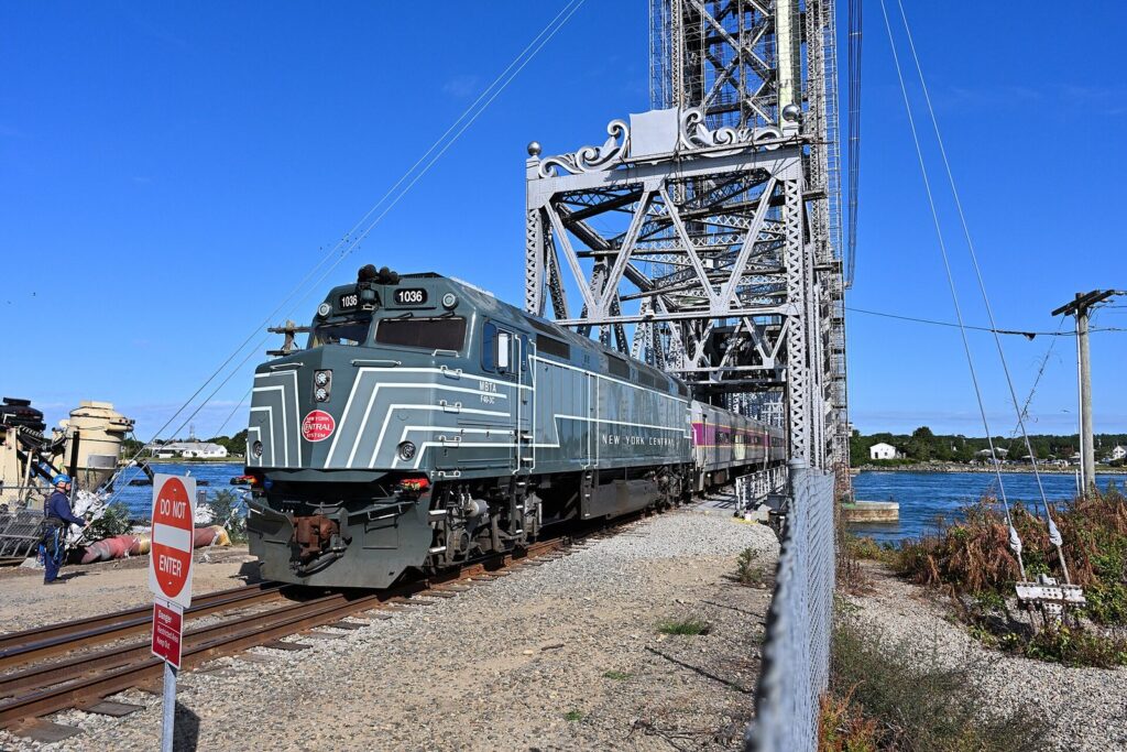
The CapeFLYER is a seasonal train from Boston’s South Station to Hyannis, stopping at Braintree, Brockton, Lakeville, Wareham, Buzzards Bay and Bourne. The 2026 season began on Friday, May 22, with service on Fridays, Saturdays and Sundays from Memorial Day to Labor Day, plus holidays. Fares from Boston, Braintree or Brockton to Hyannis are $22 one way and $40 round trip, and children 11 and under ride free with an adult. Bikes ride free in a dedicated bike car, which makes it a good way to start a cycling trip. In Hyannis, the train stops at the transportation center, where the local buses meet it.
Buses from Boston and Logan
Plymouth & Brockton runs daily buses between Hyannis, Boston’s South Station and Logan Airport, stopping at Barnstable, Sagamore, Plymouth and Rockland, with some Logan Direct trips that skip the intermediate stops; it also runs a Woods Hole route to Boston and Logan. Service runs every day except Thanksgiving, Christmas and New Year’s Day. Peter Pan runs from Logan Airport to Woods Hole with a Falmouth stop, serving the Steamship Authority piers, and runs daily buses to Provincetown from Hyannis, Boston and Logan. Check both operators’ current schedules and fares, which change through the year.
Ferries to Provincetown
Provincetown is the one Cape town you can reach by sea from Boston. Bay State Cruise Company’s fast ferry takes about 95 minutes; in 2026 it ran daily from May 16 to October 18 and then on weekends to November 15, with an adult round trip of $128, a child round trip of $90, and bikes at $10 each way plus a fuel surcharge. Boston Harbor City Cruises runs a competing fast ferry from mid-May to mid-October. From Plymouth, Captain John Boats runs a 90-minute crossing that leaves at 9 a.m. and returns from Provincetown at 4:30 p.m., with round trips at $59 on weekdays and $69 on weekends. All of them land at MacMillan Pier, in the middle of town.
Flying to Cape Cod: which airport?
Boston Logan (BOS) has by far the most flights, and it’s the best choice for most travelers. Buses run from Logan to Hyannis, Woods Hole and Provincetown, and Cape Air connects Logan to Provincetown. With a rental car, the Sagamore Bridge is a little over an hour away with clear roads.
Providence T.F. Green (PVD) is a useful alternative for the Upper Cape, especially Falmouth and Woods Hole, because it sits on the I-195 side of the canal and leads to the Bourne Bridge. It’s best with a rental car.
Cape Cod Gateway Airport (HYA) in Hyannis, officially Barnstable Municipal Airport, handles Cape Air’s short flights to Nantucket and Martha’s Vineyard, and in summer JetBlue flies daily to and from New York JFK, starting June 25 in 2026. Check the airport’s current airline list before you plan around it, since routes change by season.
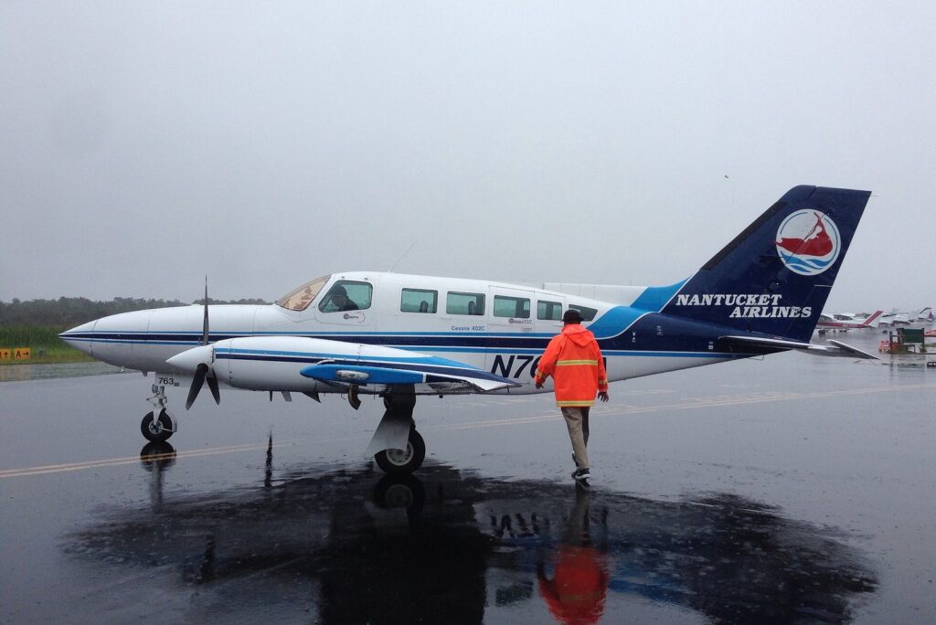
Provincetown (PVC) is served by Cape Air from Boston, daily from May 14 to November 2 in 2026, and on a reduced schedule through the winter: Thursday to Sunday from Provincetown and Wednesday to Saturday from Boston between November 4, 2026 and May 12, 2027. The flight is short, and in summer the free Provincetown Shuttle stops at the airport.
Getting around Cape Cod
By car
A car is the easiest way to reach beaches, trailheads and small villages, and outside Provincetown, Falmouth and Hyannis it’s close to essential. Budget for parking: National Seashore beaches cost $25 per car per day, town beaches need stickers or day passes, and Provincetown’s town lots charge by the hour. Rental cars are available at Logan, Providence and Hyannis; book early for summer.
By fare-free bus
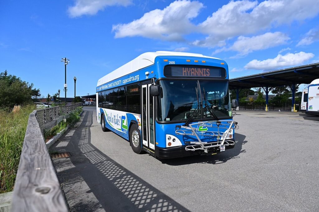
Every Cape Cod Regional Transit Authority fixed route has been fare-free since June 2025, which makes the bus a genuinely useful way to get around. The main routes:
- Sealine: the Hyannis Transportation Center to the Steamship Authority docks in Woods Hole, via Mashpee Commons, Falmouth and Route 28.
- H2O: Hyannis to Orleans along Route 28, through Yarmouth, Dennis, Harwich and Chatham.
- FLEX: Harwich to Provincetown via Brewster, Orleans, Eastham, Wellfleet and Truro, Monday to Saturday from about 7 a.m. to 7:15 p.m.; it can detour up to three-quarters of a mile off the route for riders who need it.
- Provincetown/North Truro Shuttle: in summer, every 20 minutes from MacMillan Pier to Herring Cove Beach, the Province Lands Visitor Center, Race Point Beach, the airport and North Truro, from Memorial Day weekend into the fall.
- WHOOSH Trolley: a seasonal Falmouth route from the Falmouth mall along Route 28 and Woods Hole Road to the ferry terminal, seven days a week from Memorial Day weekend to Labor Day.
- Local routes in and around Hyannis (the Barnstable Villager, Hyannis Crosstown and Hyannis Trolley), Bourne (the Bourne Run) and Sandwich (the Sandwich Line).
Each bus carries up to three bikes on a front rack, and folding bikes can come aboard. CCRTA’s GoApp handles trip planning, and its DART service offers demand-response rides for $3. Buses run less often than in a city, so check the schedule and plan connections with a margin.
By bike
The Cape is made for cycling. The Cape Cod Rail Trail runs about 25 paved miles from Dennis to Wellfleet, the Shining Sea Bikeway runs 10.7 miles from North Falmouth to Woods Hole, the Province Lands trail loops through the Provincetown dunes, and the service roads along the canal are flat and car-free. Bike shops rent near the main trailheads in season. On roads, stay alert: many Cape roads have narrow shoulders and summer drivers who are looking at the scenery.
By taxi and rideshare
Taxis and rideshare services work in the busier towns, especially Hyannis, Falmouth and Provincetown in summer, but drivers thin out late at night, in the off-season and on the Outer Cape. For an early ferry or a late arrival, book a local taxi ahead rather than counting on an app.
Getting around each part of the Cape
How much you’ll need a car depends on where you stay.
| Region | Car needed? | Best transit | Bike routes |
|---|---|---|---|
| Upper Cape | Helpful; optional in Falmouth and Woods Hole | Sealine to Hyannis; WHOOSH Trolley in summer; buses to Boston and Logan | Shining Sea Bikeway, canal service roads |
| Mid Cape | Helpful; optional near Hyannis’s center | The Hyannis hub: CapeFLYER, intercity buses, local routes, ferries | Rail Trail from Dennis |
| Lower Cape | Yes, for most trips | H2O along Route 28; FLEX from Harwich and Orleans | Rail Trail through Harwich, Brewster and Orleans |
| Outer Cape | Yes, except in Provincetown | FLEX, Monday to Saturday; the Provincetown Shuttle in summer | Rail Trail to Wellfleet, Nauset Bike Trail, Province Lands trail |
Bringing a bike: what each carrier allows
A bike turns a car-free trip from possible into pleasant, and most carriers take them for little or nothing.
| Carrier | Bikes? | 2026 bike cost |
|---|---|---|
| CapeFLYER train | Yes, in a dedicated bike car | Free |
| CCRTA buses | Up to three per bus on the rack; folding bikes on board; no motorized bikes | Free |
| Steamship Authority, Woods Hole to Martha’s Vineyard | Yes | $5.25 one way |
| Hy-Line, Hyannis to Nantucket | Yes | $8.50 one way, $17 round trip |
| Bay State Cruise Company, Boston to Provincetown | Yes | $10 one way, plus a fuel surcharge |
| Captain John Boats, Plymouth to Provincetown | Yes | $15 |
Rack space on buses and ferries can run out on busy summer days, so travel early, and lock up at trailheads: bikes left unlocked at beach lots do sometimes disappear.
What does it cost? A family of four compared
A few 2026 examples show how the options stack up for two adults and two children aged 11 or under:
- CapeFLYER, Boston to Hyannis and back: two adult round trips at $40 each, and the children ride free with an adult, so $80 in total.
- Fast ferry, Boston to Provincetown and back: two adult round trips at $128 and two child round trips at $90 on Bay State Cruise Company, so $436, and no car needed at the other end.
- Steamship Authority day trip from Woods Hole to Martha’s Vineyard: $11 per adult each way, and children pay a lower fare, which makes it the cheapest island day by far.
- Driving: the cost is gas plus parking, including $25 a day at National Seashore beaches or the $60 season pass, town beach fees, and up to $40 a day in Provincetown’s MacMillan Pier Lot.
For a family staying a week in one place, a car usually wins on flexibility. For a couple heading to Provincetown or Falmouth, the train, bus or ferry can be cheaper and far less stressful.
Door-to-door plans that work
These are the car-free and car-light routes that visitors ask about most, stitched together from the operators’ 2026 schedules.
Boston to Provincetown without a car
Take a fast ferry from Boston in season, about 95 minutes to MacMillan Pier, or a Peter Pan bus from Boston or Logan. Walk to your guesthouse, rent a bike for the Province Lands trail, and use the free Provincetown Shuttle for Herring Cove and Race Point. Out of season, Cape Air flies from Logan, and buses keep running.
Logan Airport to Martha’s Vineyard
Take Peter Pan or Plymouth & Brockton from Logan to Woods Hole, which drops you at the Steamship Authority piers. The ferry reaches Vineyard Haven or Oak Bluffs in 45 minutes for $11 per adult each way in 2026, and foot passengers don’t need reservations. It’s the simplest island connection on the East Coast without a car.
Boston to Nantucket via Hyannis
On a summer weekend, take the CapeFLYER to Hyannis; any day, take a Plymouth & Brockton bus from South Station or Logan. From the transportation center it’s a short ride or walk to the ferry docks, where the Steamship Authority’s fast ferry takes an hour ($48.50 one way in 2026) and Hy-Line’s high-speed boat takes 60 minutes ($52 one way).
New York to Cape Cod
By car, take I-95 and I-195 east to Route 25 and the Bourne Bridge; leave early on a Friday or travel midweek. By air, JetBlue’s seasonal JFK to Hyannis flight lands you at the transportation hub of the Cape. By rail, take a train to Boston’s South Station and connect to the CapeFLYER on summer weekends or a bus any day.
Providence to Falmouth and Woods Hole
Fly into T.F. Green, rent a car, and follow I-195 east to Route 25 and the Bourne Bridge, then Route 28 south to Falmouth. You’ll never touch the Sagamore Bridge or the Boston traffic, and Woods Hole’s ferries are at the end of the road. Leave the car at your inn for a day and ride the Shining Sea Bikeway instead.
Hyannis to Provincetown by bus
Peter Pan runs daily from Hyannis to Provincetown, which is the simplest option. With more time, take the H2O along Route 28 to Orleans and change to the FLEX for the Outer Cape, Monday to Saturday, a slow but fare-free way to see the towns along Route 6.
A week on the Outer Cape without a car
Arrive in Provincetown by ferry or bus and use the FLEX to reach Truro, Wellfleet and Eastham, with a bike for the Rail Trail’s northern end and the Seashore’s Nauset Bike Trail. It takes patience, since the FLEX runs Monday to Saturday only, but it works well for a stay built around beaches, bikes and one base.
Ferries to Martha’s Vineyard and Nantucket
The islands aren’t part of Cape Cod, but the Cape is where most visitors catch the boat.
| Route | Operator | Time | 2026 adult fare |
|---|---|---|---|
| Woods Hole to Vineyard Haven or Oak Bluffs | Steamship Authority | 45 minutes | $11 one way |
| Hyannis to Nantucket (fast) | Steamship Authority | 1 hour | $48.50 one way |
| Hyannis to Nantucket (traditional) | Steamship Authority | 2 hours 15 minutes | $21.50 one way |
| Hyannis to Nantucket (high-speed) | Hy-Line Cruises | 60 minutes | $52 one way, $97 round trip |
| Hyannis to Oak Bluffs (seasonal) | Hy-Line Cruises | 1 hour | $41 one way, $78 round trip |
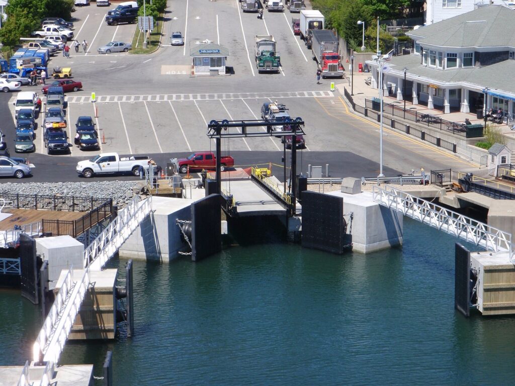
Taking a car to either island requires a reservation, and summer spaces go fast: the Steamship Authority’s 2026 Head Start booking opened on January 13 for travel from May 14 to October 22. Reservations for travel from January 6, 2027 open on October 20, 2026. Foot passengers can usually just buy a ticket and board. There’s no dockside parking at Woods Hole; drivers use the Authority’s lots in Falmouth, with free shuttle buses to the terminal, and should allow about an hour before departure.
When to cross the bridges: traffic timing
Traffic on and off the Cape follows a predictable weekly rhythm in summer.
- Saturday is the worst day in both directions, because traditional weekly rentals run Saturday to Saturday. Cross before 10 a.m. or after 7 p.m.
- Friday afternoon and evening is the heaviest time coming onto the Cape.
- Sunday afternoon is the heaviest time leaving.
- Holiday weekends, including Memorial Day, the Fourth of July, Labor Day and Columbus Day / Indigenous Peoples’ Day, magnify all of the above.
- Midweek crossings, Tuesday to Thursday, are usually the easiest in any season.
Once you’re across, the bottlenecks move: Route 6 toward Orleans on summer mornings, Route 28 and Route 132 around Hyannis in the afternoon, and the Outer Cape stretch of Route 6, where one slow car can set the pace for miles. Check live conditions on MassDOT’s Mass511 service before you set out, especially while the bridge work ramps up. For itineraries that dodge the worst of it, see our Cape Cod itineraries.
Parking on Cape Cod
Beaches: the National Seashore charges $25 per car per day at its six beaches, or $60 for an annual pass, and town beaches need stickers or day passes that vary by town; Orleans, for example, charges $35 a day at Nauset and Skaket in 2026.
Provincetown: the town’s MacMillan Pier Lot charges $4 an hour up to $40 a day, and Grace Hall Lot $3 an hour up to $30, both card-only, with enforcement from May 1 to November 2 in 2026. Park once and walk.
Ferries: at Woods Hole there’s no dockside parking, so use the Steamship Authority’s Falmouth lots and shuttles. In Hyannis, the ferry operators run their own lots near the terminals; arrive early on summer weekends.
Villages: parking in the centers of Chatham, Falmouth and Hyannis is limited and often time-limited in summer. Arrive before 10 a.m., or take the bus in.
Getting around in the off-season
Transit thins out after summer. The CapeFLYER stops after Labor Day, the WHOOSH Trolley ends at Labor Day, and the Provincetown Shuttle’s frequent summer service winds down in the fall. Bay State Cruise Company’s Provincetown ferry runs weekends only after mid-October and stops in mid-November, and Cape Air moves to a reduced winter schedule between Boston and Provincetown. The intercity buses keep running daily, the fare-free FLEX and Route 28 buses continue, and the Steamship Authority sails to the islands all year on reduced schedules. In winter, plan on a car or a single well-connected base, and book taxis ahead.
Accessible travel
CCRTA runs ADA paratransit alongside its fixed routes, and its DART service offers door-to-door demand-response rides; the FLEX can also detour up to three-quarters of a mile off its route for riders who need it. On the beaches, the National Seashore lends beach wheelchairs in summer at Coast Guard, Nauset Light, Head of the Meadow, Race Point and Herring Cove, and lays Mobi-Mats over the sand. Ask ferry and bus operators about boarding assistance when you book.
Cape Cod Transportation FAQ
Do you need a car on Cape Cod?
For most trips, yes, because beaches, trailheads and villages are spread out. You can manage without one if you stay in Provincetown, Falmouth or Hyannis and use the fare-free CCRTA buses, bikes and ferries. Provincetown is the easiest car-free base, with fast ferries from Boston and a free summer shuttle to the beaches.
How do you get from Boston to Cape Cod without a car?
Take the CapeFLYER train from South Station to Hyannis on summer weekends ($22 one way in 2026), a daily Plymouth & Brockton or Peter Pan bus from South Station or Logan, or a fast ferry to Provincetown, about 95 minutes, from mid-May to mid-October. Once on the Cape, fare-free CCRTA buses connect the main towns.
Is there a train to Cape Cod?
Yes, in summer. The CapeFLYER runs from Boston’s South Station to Hyannis on Fridays, Saturdays and Sundays from Memorial Day to Labor Day, stopping at Buzzards Bay and Bourne. Bikes ride free. Outside that season, there’s no passenger train, so use the buses.
What airport is closest to Cape Cod?
Cape Cod Gateway Airport in Hyannis and Provincetown’s airport are on the Cape itself, with limited, mostly seasonal service. For most travelers, Boston Logan is the best choice, with daily buses to Hyannis, Woods Hole and Provincetown. Providence’s T.F. Green works well for Falmouth and the Upper Cape if you’re renting a car.
How long does it take to drive from Boston to Cape Cod?
About an hour to the Sagamore Bridge with clear roads, then about 25 to 30 minutes more to Hyannis, 45 to 50 to Chatham and 1 hour 15 minutes to Provincetown. On summer Fridays, Saturdays and holiday weekends, the same trip can take twice as long.
Is Uber available on Cape Cod?
Rideshare works in the busier towns, especially Hyannis, Falmouth and Provincetown in summer, but drivers can be scarce late at night, in the off-season and on the Outer Cape. For early ferries or late arrivals, book a local taxi ahead.
Can you bring a bike on the CapeFLYER or the buses?
Yes. Bikes ride free on the CapeFLYER in a dedicated bike car, and every CCRTA bus carries up to three bikes on its rack, with folding bikes allowed on board and no motorized bikes. The island and Provincetown ferries also take bikes for a small fee, from $5.25 one way to Martha’s Vineyard.
Related Cape Cod Guides
- Where to Stay on Cape Cod: bases that work with or without a car
- Cape Cod Itineraries and Day Trips: day plans built around realistic drive times
- Cape Cod Towns and Villages: where each town sits and how far it is from the bridges
- Best Time to Visit Cape Cod: when trains, ferries and shuttles run
- Cape Cod Travel Guide: planning the whole trip
Sources and verification
The details on this page were checked on September 23, 2026 against the agencies and operators listed below. The guide is compiled from those sources and claims no first-hand travel.
- CapeFLYER
- Cape Cod Regional Transit Authority
- CCRTA: fares
- CCRTA: bikes on buses
- Plymouth & Brockton: Hyannis to Boston and Logan
- Peter Pan Bus Lines
- Bay State Cruise Company
- Boston Harbor City Cruises
- Captain John Boats
- Cape Air
- Cape Cod Gateway Airport: flights
- Steamship Authority
- Steamship Authority: parking
- Hy-Line Cruises
- MassDOT: Cape Cod Bridges Program updates
- Town of Provincetown: parking for visitors
- Cape Cod National Seashore: fees
Cape Cod Tourism Guide is an independent publication, not affiliated with the Cape Cod Chamber of Commerce, the National Park Service or any business named here.
Photo credits
- CapeFLYER on the Cape Cod Canal Railroad Bridge: photo by 4300streetcar, Wikimedia Commons (CC BY 4.0)
- Bourne Bridge: photo by John Phelan, Wikimedia Commons (CC BY 3.0)
- Cessna 402C at Provincetown Municipal Airport: photo by Edward Russell, Wikimedia Commons (CC BY 2.0)
- CCRTA battery-electric bus, Hyannis: photo by 4300streetcar, Wikimedia Commons (CC BY 4.0)
- Hyannis Ferry Terminal: photo by MassDOT, Wikimedia Commons (public domain)