Most first trips to Cape Cod go wrong on the map, not on the beach. The Cape looks compact, a crooked arm of sand you can drive from end to end in about an hour and a quarter on empty roads, so people book one cottage and try to see all of it from there. In July the roads are rarely empty. This Cape Cod travel guide is built to head off that mistake. It explains how the peninsula is laid out, which region suits which kind of trip, how long to stay, when to come, how to get here with or without a car, what things really cost and what to book first.
Everything that changes from year to year, including fees, fares, schedules and the bridge project, was checked in September 2026 against the agency or company that sets it, and the sources are listed at the end. Where we couldn’t confirm a number, we say so instead of guessing.
Looking for the printed booklet? The Cape Cod Chamber of Commerce publishes an annual visitor guide of the same name, which you can order from the Chamber. This page is the planning layer in front of a directory like that: fewer listings, more decisions.
On this page: At a glance · The four regions · Choosing a base · How long to stay · When to come · Getting here · Getting around · Beach rules · What the Cape does best · Costs · What to book · Know before you go · Questions
Cape Cod at a Glance
If you’re visiting Cape Cod for the first time, these are the answers that shape everything else.
| Question | Short answer |
|---|---|
| Where is it? | Southeastern Massachusetts. The Cape starts at the Cape Cod Canal, about 60 miles from downtown Boston, and runs roughly 65 miles out to Provincetown. |
| How is it divided? | Fifteen towns, all in Barnstable County, usually grouped into four regions: the Upper, Mid, Lower and Outer Cape. |
| How do most people arrive? | By car, over the Sagamore or Bourne Bridge. A summer train, buses, ferries and small planes cover the rest. |
| Do I need a car? | For most trips, yes. Provincetown, Hyannis and Falmouth work without one if you’re happy to stay close to your base. |
| When is the main season? | Late June through Labor Day. June and September into mid-October are calmer and, for many visitors, better. |
| How long should I stay? | Two or three nights for one region. A week to see two regions without spending your days in the car. |
| What does it cost? | Lodging is the big number by a wide margin. After that come beach parking ($25 a car per day at the National Seashore), ferries and eating out. |
| What is the National Seashore? | A national park covering 43,607 acres and nearly 40 miles of ocean shore on the Outer Cape, with six beaches that have lifeguards in summer. |
How Cape Cod Is Laid Out
Henry David Thoreau, who walked the Cape’s outer beach on several trips between 1849 and 1857, called it “the bared and bended arm of Massachusetts.” In his telling the shoulder is at Buzzards Bay, the elbow out near Chatham, the wrist at Truro and the “sandy fist” at Provincetown. More than 160 years later it is still the easiest way to hold the place in your head, and the view from orbit shows why.
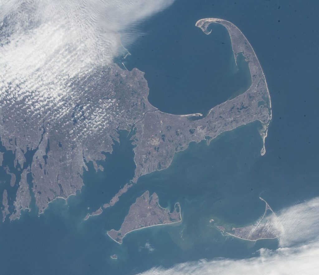
The Cape Cod Canal, opened in 1914, cuts the arm off from the mainland. Every car that comes or goes uses one of two bridges dedicated in 1935: the Sagamore, which feeds Route 6 toward the middle and far end of the Cape, and the Bourne, which feeds Route 28 toward Falmouth. About 230,000 people live here year-round, according to the 2020 census, and estimates of the summer population run well past 400,000. That second number explains most of what goes wrong on a summer Saturday.
The regional names trip up newcomers because they read upside down on a map. The Upper Cape is the end nearest the mainland. The Mid Cape is the middle. The Lower Cape runs out to the elbow, and the Outer Cape is the forearm and fist. Each region has its own personality, and choosing between them matters more than choosing a hotel.
Upper Cape: Bourne, Sandwich, Falmouth and Mashpee
The Upper Cape is the quickest to reach, which makes it the natural choice for a long weekend. Sandwich, settled in 1637 and the oldest town on the Cape, has a boardwalk across the salt marsh to Town Neck Beach, the Sandwich Glass Museum, and Heritage Museums and Gardens, at its best when the rhododendrons bloom in late May and June. Falmouth has a walkable Main Street, warm beaches on both Buzzards Bay and Nantucket Sound, and the Shining Sea Bikeway to Woods Hole, a working science village and the main ferry port for Martha’s Vineyard. Mashpee is the seat of the Mashpee Wampanoag Tribe, whose ancestors have lived on this land for thousands of years. Bourne holds the canal itself, with paved paths along both banks for cyclists, walkers and people fishing for striped bass.
Best for: short trips, Martha’s Vineyard, and families who want warm, calm water. Think twice if: your trip is really about the National Seashore, whose beaches are more than an hour’s drive from Falmouth even with clear roads.
Mid Cape: Barnstable, Yarmouth and Dennis
Barnstable is the Cape’s biggest town and is really seven villages: Barnstable Village, Centerville, Cotuit, Hyannis, Marstons Mills, Osterville and West Barnstable. Hyannis is the hub, with the bus terminal, the summer train, year-round ferries to Nantucket, the JFK Hyannis Museum and a walkable Main Street. Yarmouth splits in two: motels, mini golf and family restaurants along Route 28 on the south side, sea captains’ houses and the Bass Hole boardwalk along Route 6A on the north. Dennis has Mayflower Beach and the bay-side flats, the Cape Playhouse, which has staged summer theater since 1927, and the view from Scargo Tower.
Best for: first-timers who want most of the Cape within an hour, travelers without a car (Hyannis), and families who need rainy-day backups. Think twice if: you picture Cape Cod as dunes and lighthouses. Parts of the Mid Cape’s south side are more strip mall than seashore.
Lower Cape: Brewster, Harwich, Chatham and Orleans
Brewster sits on the bay, where low tide uncovers sand flats that reach more than a mile from shore. It also has Nickerson State Park, with freshwater ponds, camping and bike paths, and a long stretch of the Cape Cod Rail Trail. Harwich faces Nantucket Sound, with gentle beaches, the small harbor at Harwich Port and cranberry bogs inland. Chatham is the elbow: a Main Street made for strolling, Chatham Light, a fish pier where gray seals loiter when the boats come in, and boat trips toward Monomoy National Wildlife Refuge. Orleans is where Routes 6 and 6A meet on the way to the Outer Cape, with Nauset Beach on the Atlantic and Skaket Beach and Rock Harbor, the Lower Cape’s sunset spots, on the bay.
Best for: a week-long base that reaches both the classic villages and the Seashore. Orleans is the hinge, about 20 minutes from Chatham or Wellfleet and around 45 from Provincetown with clear roads. Think twice if: you want a short drive home on departure day.
Outer Cape: Eastham, Wellfleet, Truro and Provincetown
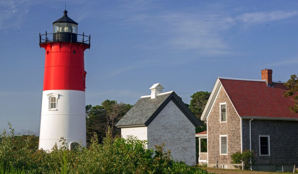
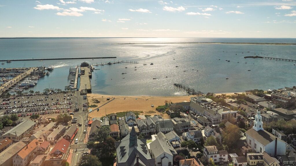
This is National Seashore country. Eastham has the Salt Pond Visitor Center, Coast Guard Beach, Nauset Light and, on the bay, First Encounter Beach, named for the December 1620 clash between the Mayflower’s passengers and Nauset men. Wellfleet is oysters, a working harbor, Marconi Beach, the Great Island trail and a drive-in movie theater. Truro is the quietest town on the Cape, all dunes, kettle ponds and Highland Light. Provincetown, at the end of Route 6, is where the Pilgrims first came ashore in November 1620. Today it is a harbor town of galleries, restaurants and guesthouses along Commercial Street, with a long-established LGBTQ+ community, whale-watch boats at the pier and the dunes of the Province Lands at its back.
Best for: ocean beaches, dunes, walking and cycling, and, in Provincetown, a trip without a car. Think twice if: you want warm water, because the Atlantic side stays cold well into summer, or if a quick exit off-Cape matters to you.
Four Waters, Four Kinds of Beach Day
- Cape Cod Bay, inside the arm: calm and shallow, with big tides. On the Lower Cape the water drains away at low tide to leave wide sand flats, and the shallows warm quickly on a sunny incoming tide. Sunsets face west over the water.
- Nantucket Sound, along the south shore: gentle waves and usually the warmest swimming on the Cape, from Falmouth to Chatham.
- The Atlantic, on the ocean side of the Outer Cape and at Nauset in Orleans: cold water, real surf, rip currents, and gray seals with the white sharks that hunt them, all backed by cliffs and dunes.
- Buzzards Bay, on the west side of Bourne and Falmouth: warm, sheltered water and sunset views.
The Three Roads That Matter
Route 6, the Mid-Cape Highway, is the fast spine from the Sagamore Bridge to the rotary in Orleans. Past Orleans it becomes an ordinary road, with traffic lights and turning traffic through Eastham, Wellfleet and Truro. Route 6A, the Old King’s Highway, follows the bay side from Sandwich to Orleans through a protected historic district of sea captains’ houses, antique shops and farm stands, and it is slow on purpose. Route 28 runs along the south side from Falmouth through Hyannis, Yarmouth, Harwich and Chatham to Orleans. In places it is a commercial strip, but it is also how you reach the Nantucket Sound beaches.
Rough Drive Times With Clear Roads
| Route | Distance | Time with clear roads |
|---|---|---|
| Downtown Boston to the Sagamore Bridge | About 60 miles | About 1 hour |
| Sagamore Bridge to Hyannis | About 20 miles | 25 to 30 minutes |
| Sagamore Bridge to Chatham | About 40 miles | 45 to 50 minutes |
| Sagamore Bridge to Provincetown | About 63 miles | About 1 hour 15 minutes |
| Bourne Bridge to Woods Hole | About 17 miles | About 25 minutes |
| Hyannis to Provincetown | About 50 miles | About 1 hour 5 minutes |
| Falmouth to Provincetown | About 75 miles | About 1 hour 40 minutes |
These are rounded, off-peak figures. On summer Friday afternoons and Saturdays, traffic can back up for miles before the bridges, and losing an hour before you even reach the canal is common. Plan the first and last days of a summer trip around that, not around the map.
Choosing a Base
Pick the region before you pick the room. A bargain rental in the wrong town costs you in driving time, and in summer, driving time is the scarcest thing you have.
| Your trip | Base yourself in | Why it works | The catch |
|---|---|---|---|
| First visit, a week, with a car | Dennis, Brewster or Orleans | Chatham, the Seashore and Provincetown are all day trips, and bay and ocean beaches are both close | A longer drive on arrival and departure days |
| A long weekend from Boston or New York | Sandwich or Falmouth | The shortest run from the bridges, so more of the weekend happens on the Cape | You’ll see little of the Outer Cape |
| No car | Provincetown, Hyannis or Falmouth | Walkable centers with ferries, free buses and, in Hyannis, the summer train | Each covers its own slice of the Cape well and the rest poorly |
| Young children | The bay side of Dennis or Brewster, or the Sound side of Harwich or Yarmouth | Shallow, gentle water and short drives | Bay-side swimming depends on the tide |
| Beaches, dunes, hiking and cycling | Eastham or Wellfleet | Next door to the Seashore and the Rail Trail | Cold ocean water, quiet evenings, fewer rainy-day options |
| Restaurants, galleries and nightlife on foot | Provincetown | Nearly everything is walkable, and ferries run to Boston in season | It’s the end of the road, and the rest of the Cape is an hour or more away |
| An island day trip | Falmouth for Martha’s Vineyard, Hyannis for Nantucket | You’re minutes from the ferry | Summer ferries fill up, especially for cars |
One base or two? For five nights or fewer, stay put. For a week or longer, splitting the trip usually works better: three or four nights on the Upper or Mid Cape, then the rest on the Lower or Outer Cape. You change beds once and lose the longest daily drives. The catch is that many traditional summer rentals run Saturday to Saturday, so a split trip is easier with hotels and inns, or with two shorter rentals booked back to back.
How Long to Stay
| Trip length | What fits | How to do it |
|---|---|---|
| A day from Boston | One place, done properly | Sandwich and the canal by car, or Provincetown by fast ferry. Driving to the Outer Cape and back in a summer day mostly means sitting in traffic. |
| Two or three nights | One region | Falmouth and Woods Hole, or Chatham and Orleans, or Provincetown on its own. |
| Four or five nights | One base plus one long day | Add Provincetown, the Seashore or an island to a Mid or Lower Cape base. |
| A week | Two regions | Two bases, or one central base between Dennis and Orleans and two long days out. |
| Ten nights or more | Most of the Cape, at an easy pace | Stay overnight on an island instead of day-tripping, and leave days unplanned for weather. |
First-timer threads on travel forums are full of week-long plans that squeeze Hyannis, Provincetown, Martha’s Vineyard and Nantucket into seven days. It can be done, but you would spend the week in cars and on ferries. Pick one island per trip and give the Cape itself the rest.
When to Come
| Season | What you get | What to watch for |
|---|---|---|
| Late June to Labor Day | Everything open, lifeguards at the Seashore’s six beaches, baseball, band concerts and the warmest water, usually in August | Peak prices, minimum stays, beach lots full by late morning on hot days, bridge traffic every weekend |
| September to mid-October | Warm days, water on the bay and Sound side that holds some summer warmth, thinner crowds, most restaurants still open | No lifeguards after Labor Day, shorter hours, and closures after the Columbus Day and Indigenous Peoples’ Day weekend. September is also peak hurricane season. |
| Late October to April | The lowest prices, empty beaches, seals, and holiday strolls in the villages | Many seasonal businesses close, especially on the Outer Cape. Expect nor’easters and short days. |
| May to mid-June | Gardens in bloom, migrating birds and early-season quiet | Cold ocean water, changeable weather, and some places open only on weekends until late June |
If you can pick only one window, early to mid-September is hard to beat. The summer crowds have gone home, the water on the Sound and bay side is still swimmable for most people, and nearly everything is still open. The trade-off is no lifeguards and a real, if small, chance of a tropical storm. For a family tied to school calendars, late June, before the Fourth of July, is the calmer corner of summer.
Getting to Cape Cod
By Car
From Boston, take Route 3 south to the Sagamore Bridge, which lands you on Route 6 for the Mid, Lower and Outer Cape. From New York, Connecticut, Providence or western Massachusetts, I-495 and Route 25 lead to the Bourne Bridge, the better choice for Falmouth, Woods Hole and Mashpee.
Timing matters more than route. The worst windows for heading onto the Cape are Friday afternoon and evening, and Saturday from late morning into the afternoon, when weekly rentals change over. Leaving, avoid Sunday from late morning on. Arrive midweek if your lodging allows it. On a Saturday-to-Saturday rental, cross early in the morning or in the evening.
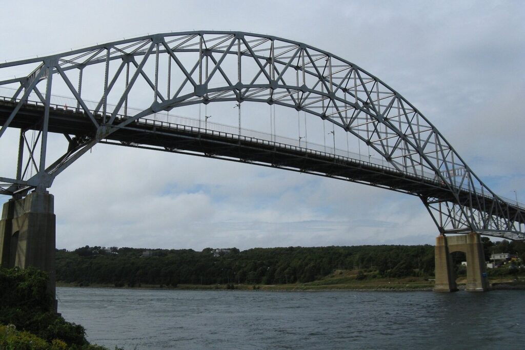
The bridge project. Both 1935 bridges are due to be replaced, the Sagamore first; the Bourne’s funding is still under review. The Sagamore job moved into procurement in 2026, and Barnstable County’s April 2026 update put major construction starting around the turn of 2027 into 2028, with traffic on the new span by 2033 and two lanes kept open each way throughout. Projects this size slip, so check MassDOT’s bridge updates for lane closures before you travel.
By Train
The CapeFLYER runs on Fridays, Saturdays and Sundays from Memorial Day to Labor Day between Boston’s South Station and Hyannis, stopping at Braintree, Brockton, Lakeville, Wareham, Buzzards Bay and Bourne. In 2026 the fare from Boston to Hyannis was $22 one way or $40 round trip. Children 11 and under rode free with an adult, and bikes rode free in a dedicated bike car. The 2026 season ended on Labor Day weekend, so check back in spring for next summer’s dates.
By Bus
Plymouth & Brockton buses connect Logan Airport and South Station with Hyannis. Peter Pan runs to Provincetown from Boston and Logan, and to Falmouth and Woods Hole. Schedules change by season, so check current times and fares with each company before you plan around them.
By Ferry
From mid-May to mid-October, fast ferries cross from Boston to Provincetown in about an hour and a half. Bay State Cruise Company’s 2026 adult round trip was $128, with daily sailings through October 18 and weekend service into mid-November. Boston Harbor City Cruises also runs the route, with prices that vary by date. From Plymouth, Captain John Boats’ fast ferry takes 90 minutes and costs $59 round trip on weekdays or $69 on weekends. Either way you step off at MacMillan Pier in the middle of Provincetown, where you won’t need a car.
By Air
Most visitors fly into Boston Logan or Providence’s T.F. Green and drive from there. Cape Air flies small planes between Boston and Provincetown, daily from mid-May to early November in 2026 and several days a week through the winter. Hyannis’s airport has only limited scheduled service, mainly to the islands.
Getting Around Once You’re Here
A car is still the default, and for most trips it is the right call. Two things soften that. First, the Cape Cod Regional Transit Authority’s fixed-route buses have been free since June 2025, and each carries up to three bikes. The routes visitors use most are the Sealine between Hyannis and Woods Hole, the H2O line along the south side between Hyannis and Orleans, and the Flex, which runs Monday through Saturday from Harwich out to Provincetown. In season, the Provincetown Shuttle links the town center with Herring Cove and Race Point beaches.
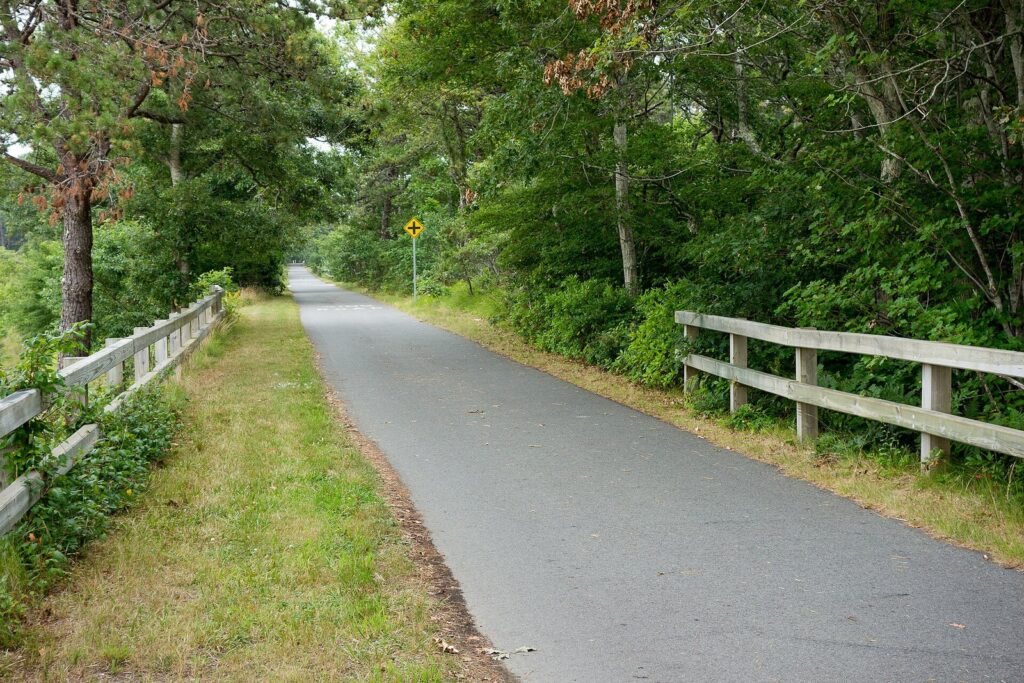
Second, the Cape is very good on a bike. The Cape Cod Rail Trail runs about 25 paved, mostly flat miles from Dennis through Harwich, Brewster, Orleans and Eastham to Wellfleet, with rental shops near several trailheads. Falmouth’s Shining Sea Bikeway covers 10.7 miles to Woods Hole, there are paved paths along both banks of the canal, and the Province Lands bike trail loops through the dunes behind Provincetown.
Martha’s Vineyard and Nantucket
Both islands work as day trips if you leave from the right port. For Martha’s Vineyard, the Steamship Authority’s traditional ferry from Woods Hole takes 45 minutes and cost $11 one way for an adult on foot in 2026, and foot passengers don’t need reservations. For Nantucket, leave from Hyannis. The fast ferries take about an hour, at $52 one way on Hy-Line or $48.50 on the Steamship Authority, while the Steamship Authority’s traditional boat takes 2 hours 15 minutes for $21.50. Bringing a car across is a different story, covered in the booking section below.
Beach Rules Nobody Explains
Cape Cod’s beaches are run by three kinds of landlord, and whoever runs the beach decides how you park, what you pay and which rules apply.
- National Seashore beaches: Coast Guard and Nauset Light in Eastham, Marconi in Wellfleet, Head of the Meadow in Truro, and Race Point and Herring Cove in Provincetown. You pay at the gate in season: $25 a car per day, $20 for a motorcycle, or $15 on foot or by bike. A $60 annual Seashore pass covers all six. The America the Beautiful pass, $80 for US residents and $250 for nonresidents since January 2026, also works. These six are the beaches with National Park Service lifeguards, typically from late June through Labor Day.
- Town beaches: most of the rest. Many lots are for residents and property owners with stickers, some sell daily parking to visitors, and many towns sell weekly or seasonal stickers to renters and visitors. Rules, prices and dates differ from town to town. Orleans, for example, charged $35 a day or $165 for a weekly sticker at Nauset and Skaket in 2026, required every day from June 20 to September 7, with walkers and cyclists free. Chatham requires stickers from the third Friday in June through Labor Day.
- State land: Nickerson State Park in Brewster and other state properties run by the Department of Conservation and Recreation have their own fees and rules.
On hot summer weekends, arrive before about 10 a.m. or after 3 p.m., because popular lots fill up and turn cars away. If you’re renting a house, ask the owner whether a beach sticker comes with it.
Tides
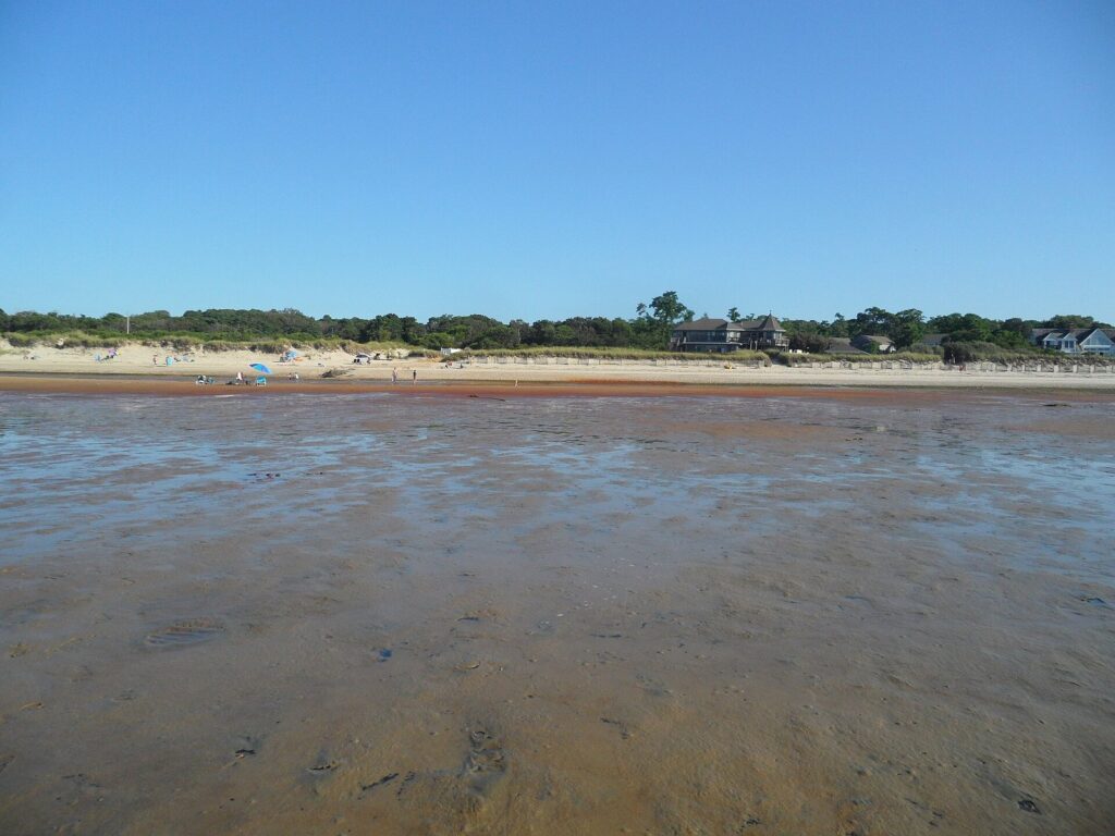
On Cape Cod Bay, the tide is the whole story. In Brewster and its neighbors, low tide can uncover flats stretching more than a mile from shore, which is wonderful for tide pools and long walks and useless for swimming. Tides on the bay run to nine or ten feet, far more than on Nantucket Sound, and high and low water arrive at different times on different shores. Check a NOAA tide prediction for the nearest station rather than a generic “Cape Cod” tide. When you walk the flats, head out on a falling tide and start back as soon as it turns.
Sharks, Seals and Surf
Gray seals have returned to the Cape in large numbers, and white sharks follow them, especially along the Atlantic side of the Outer Cape. The Seashore’s rules for swimmers are simple: swim at a lifeguarded beach, stay close to shore and near other people, keep away from seals and schools of fish, and get out when a purple shark flag is flying, because it means a shark has been seen. The Atlantic White Shark Conservancy’s free Sharktivity app logs sightings and detections reported by researchers, officials and beachgoers. The same ocean beaches have rip currents and heavy shore break. If a current pulls you out, swim parallel to the beach until you’re free of it.
Water Quality, Dunes and Birds
Barnstable County tests more than 350 bathing beaches every week in summer, starting June 1 in 2026, and posts the results online. A beach can close for a day or two after heavy rain. Stay off the dunes, which hold the Cape together, and respect roped-off areas on the sand in spring and summer. They protect nesting piping plovers and terns, and the closures can shift from day to day.
What Cape Cod Does Best
The National Seashore
President Kennedy signed Cape Cod National Seashore into law on August 7, 1961, and it now protects beach, dune, marsh, pine woods and freshwater ponds from Chatham to Provincetown. Start at the Salt Pond Visitor Center in Eastham, which is open year-round, then walk to Coast Guard Beach and Nauset Light. Farther out are Marconi Beach and the site of Guglielmo Marconi’s wireless station, which exchanged messages across the Atlantic in 1903, and Highland Light in Truro, a light station since 1797 that was moved 450 feet back from the eroding cliff in 1996 and offers tours of the tower. At the tip, the Province Lands Visitor Center, open May through October, looks out over the dunes toward Race Point.
Seafood, From Clam Shacks to Raw Bars

Cape food is at its best when it’s simplest: fried whole-belly clams from a roadside shack, a cup of chowder, and a lobster roll, cold with mayonnaise or warm with butter (locals will argue about which). Then there are oysters, named for the harbor they grew in, with Wellfleet the most famous. Lobster usually sells at market price, so read the board before you order, and since many shacks are counter service with no reservations, eat early or late in peak season. Wellfleet’s OysterFest fills the town center on October 17 and 18, 2026.
Whales, Seals and Birds
Whale-watch boats leave Provincetown and Barnstable Harbor for Stellwagen Bank National Marine Sanctuary, where humpbacks arrive in spring to feed. Most trips run from early May to the end of October and last three to four hours. Seals are easy to see from the Chatham fish pier and on boat trips toward Monomoy. For birds, Mass Audubon’s Wellfleet Bay Wildlife Sanctuary and the bay-side flats at low tide are hard to beat, especially during spring and fall migration.
Villages, History and the Wampanoag Homeland
Cape Cod was Wampanoag homeland long before it was anything else, and it still is. The Mashpee Wampanoag Tribe governs from Mashpee, and its annual powwow is held around the Fourth of July; the 105th ran from July 3 to 5, 2026. The Pilgrims’ story starts here too, not in Plymouth. The Mayflower anchored in Provincetown Harbor in November 1620, the Mayflower Compact was signed on board, and the passengers spent about five weeks exploring the Outer Cape before sailing on to Plymouth. In Provincetown you can climb the 252-foot Pilgrim Monument, 116 steps and 60 ramps, for the view in the harbor photo above. For old houses and village streets, drive Route 6A from Sandwich to Orleans, then walk Sandwich, Chatham, Falmouth’s Main Street and Provincetown’s Commercial Street.
Summer Evenings
The Cape Cod Baseball League, the summer league for top college players, fields ten teams from Wareham, just off the Cape, to Orleans. Its 2026 season opened on June 13, and games are free to watch. Add summer theater at the Cape Playhouse, a double feature at the Wellfleet Drive-In, free band concerts on town greens and a late walk down Commercial Street, and your summer nights are covered.
What a Cape Cod Trip Costs
Lodging is the biggest line in any Cape Cod vacation budget, and we don’t publish an average nightly rate for it. The spread between a Route 28 motel in May and a harbor-view inn in Chatham in August is too wide for an average to mean anything. Instead, price the same room or rental in June, July and September before you commit to dates: the shoulder weeks are often far cheaper, and in July and August many rentals only take full-week bookings. Summer 2026 rental rates rose roughly 3 to 6 percent over 2025, according to rental companies quoted by Boston.com in March.
| What | Price (checked September 2026) | Good to know |
|---|---|---|
| National Seashore beach entry | $25 per car per day | $20 motorcycle, $15 on foot or bike. The $60 annual Seashore pass pays for itself on the third day. |
| America the Beautiful pass | $80 (US residents), $250 (nonresidents) | Covers Seashore entry and national parks nationwide for a year |
| Town beach parking in Orleans | $35 a day, $165 a week | The weekly sticker pays for itself on the fifth day |
| CapeFLYER, Boston to Hyannis | $22 one way, $40 round trip | Summer weekends only. Children 11 and under ride free with an adult. |
| CCRTA buses | Free | All fixed routes, since June 2025 |
| Ferry, Woods Hole to Martha’s Vineyard | $11 one way (adult on foot) | 45 minutes. No reservation needed without a car. |
| Fast ferry, Hyannis to Nantucket | $48.50 to $52 one way | About an hour. The traditional ferry is $21.50 and takes 2 hours 15 minutes. |
| Fast ferry, Boston to Provincetown | $128 round trip (Bay State Cruise Company) | About 95 minutes. From Plymouth, $59 to $69 round trip. |
| Pilgrim Monument | $23 adults | $18 teens, seniors and veterans, $10 ages 4 to 12 |
The biggest savings are structural rather than clever. Travel in June or September. Stay on the Mid Cape and drive to the pricier villages. Buy a weekly beach sticker instead of paying daily, and walk onto the ferry instead of taking a car across.
What to Book, and When
- Your base, as early as you can. For July and August, traditional weekly rentals go fast. By January 2026, seven of ten summer weeks were already more than half booked on one major Cape rental platform, according to Boston.com, and many of those rentals run Saturday to Saturday.
- A car on the island ferries, the day bookings open. For summer 2026, the Steamship Authority opened vehicle reservations to early bookers in mid-January, with general booking for Martha’s Vineyard in early February. Expect a similar winter window for 2027. On foot, you don’t need to book the traditional Vineyard ferry at all.
- Anything with limited seats, a few weeks ahead for peak dates. That covers fast ferries on summer weekends, whale watches, popular dinner reservations and guided lighthouse tours.
- Beach parking, before you arrive. Find out whether your lodging includes a sticker. If not, check the town’s beach page for weekly stickers, or plan on the Seashore beaches, where you simply pay at the gate.
- Nothing else. Clam shacks, ice cream and most beach days don’t need a reservation. Leave room for the weather.
Know Before You Go
- Ticks and poison ivy. Both are common in the dunes, pine woods and trail edges. Stay on paths, wear long socks for walks and check for ticks every evening. Deer ticks carry Lyme disease.
- Layers. The ocean side can be cooler, windier and foggier than the bay side on the same afternoon, and evenings cool off even in August.
- Dogs. Rules vary by town and season. The Seashore requires leashes and keeps dogs off lifeguarded beaches and bird-nesting areas. Check before you go, and never read “dog-friendly” as off-leash.
- Shellfishing. Digging clams or gathering oysters requires a permit from the town, and each town sets its own rules and seasons.
- Accessibility. Some Seashore beaches have beach wheelchairs and seasonal mats over the sand, the Rail Trail and Shining Sea Bikeway are paved and level, and CCRTA buses are accessible. Call ahead to confirm equipment for the day you plan to go.
Cape Cod Travel Questions
Do you need a car on Cape Cod?
For most trips, yes. You can manage without one if you base yourself in Provincetown, Hyannis or Falmouth and accept that you’ll mostly stay near that base. CCRTA buses are free, bikes cover a lot of ground, and ferries link Provincetown with Boston and Plymouth in season.
How far is Cape Cod from Boston?
The canal is about 60 miles from downtown Boston, roughly an hour with clear roads. Hyannis is about an hour and a half away and Provincetown about two and a quarter hours, before any summer traffic. The fast ferry to Provincetown takes about 90 minutes.
Is it safe to swim with sharks around?
Shark bites are rare, but white sharks do hunt seals close to shore on the Atlantic side, so take the precautions seriously. Swim at lifeguarded beaches, stay near shore, avoid seals and schools of fish, and leave the water when the purple flag goes up. Beaches on Nantucket Sound see far fewer seals.
Can you see Chatham and Provincetown in one day?
From an Orleans or Eastham base, yes. Spend the morning in Chatham and the afternoon in Provincetown, with about an hour of driving between them on clear roads. From Falmouth or Sandwich it’s a very long day in summer traffic, so choose one.
When do Cape Cod businesses close for the season?
Hours start shrinking after Labor Day. Many seasonal restaurants, shops and attractions close after the Columbus Day and Indigenous Peoples’ Day weekend in mid-October, especially on the Outer Cape. Hyannis, Falmouth, Orleans and Provincetown keep the most going through the winter.
Sources for This Cape Cod Travel Guide
Fees, fares, schedules and project dates on this page were checked on September 23, 2026 against these primary sources:
- Cape Cod National Seashore fees and passes, guide to beaches and beach safety
- Barnstable County canal bridge update, April 2026 and MassDOT Cape Cod bridges updates
- CapeFLYER fares and routes and Cape Cod Regional Transit Authority fares
- Steamship Authority fares and Hy-Line Cruises Nantucket ferry
- Bay State Cruise Company schedule and fares and Captain John Boats Provincetown ferry
- Cape Air routes
- Town of Orleans beach parking and Town of Chatham beach parking
- Barnstable County bathing beach water quality
- Cape Cod Baseball League, Pilgrim Monument, Wellfleet OysterFest and the Mashpee Wampanoag Tribe
Cape Cod Tourism Guide is an independent publication. We are not affiliated with the Cape Cod Chamber of Commerce, the National Park Service, the Steamship Authority or any business named on this page, and no one paid to be included.
Photo Credits
Nauset Light, Eastham: photo by Peter K Burian / Wikimedia Commons (CC BY-SA 4.0)
Cape Cod, Martha’s Vineyard and Nantucket from the International Space Station: photo by NASA / Wikimedia Commons (Public domain; cropped)
Provincetown Harbor and Long Point from the Pilgrim Monument: photo by RoySmith / Wikimedia Commons (CC BY-SA 4.0)
Sagamore Bridge over the Cape Cod Canal: photo by John Phelan / Wikimedia Commons (CC BY 3.0)
Cape Cod Rail Trail in Harwich: photo by Kenneth C. Zirkel / Wikimedia Commons (CC BY-SA 4.0)
Brewster Flats at low tide: photo by EgorovaSvetlana / Wikimedia Commons (CC BY-SA 4.0)
Wellfleet oysters: photo by Paulo O from Halifax, Canada / Wikimedia Commons (CC BY 2.0)