Cape Cod biking and hiking trails are mostly flat, paved or sandy, and shorter than their reputation. Four bike routes do most of the work: the Cape Cod Rail Trail (about 25 miles through the Mid and Lower Cape to Wellfleet), the Shining Sea Bikeway (10.7 miles from North Falmouth to Woods Hole), the paved service roads along the Cape Cod Canal, and the National Seashore’s three bike trails. Hiking here means short nature trails through marsh, swamp and dune, plus a few long walks in soft sand that are harder than any hill.
This page is for anyone planning a ride or a walk rather than just reading about one: where to start, where to park, what the surface is like, which routes suit kids and what the rules are. The caveat that matters: every landlord sets its own rules for e-bikes, dogs and closures, and summer crowds change the experience more than the route does. Details were checked September 23, 2026 against official sources.
On this page: Routes at a glance · Choosing a route · Cape Cod Rail Trail · Shining Sea Bikeway · Canal service roads · Seashore bike trails · Ride plans · Hiking trails · With kids · Getting your bike here · Rules and safety · When to go · FAQ
Cape Cod’s main bike and hiking routes at a glance
| Route | Length | Surface | Best for | Where to start |
|---|---|---|---|---|
| Cape Cod Rail Trail | About 25 miles one way, plus a western extension to South Yarmouth | Paved | Long rides, or short family sections | Route 134 in South Dennis, Nickerson State Park, Salt Pond Visitor Center |
| Old Colony Rail Trail | A branch off the Rail Trail | Paved | Riding into Chatham | The junction in Harwich |
| Shining Sea Bikeway | 10.7 miles one way | Paved | Families, marsh and water views, the Woods Hole ferry | County Road in North Falmouth |
| Cape Cod Canal service roads | About 13.5 miles, split between the two banks | Paved | Easy flat miles and ship watching | Access areas on both banks |
| Province Lands Bike Trail | 5.45-mile loop, plus spurs | Paved | Dunes and hills | Province Lands Visitor Center, Provincetown |
| Nauset Bike Trail | 1.6 miles one way | Paved | A short ride to Coast Guard Beach | Salt Pond Visitor Center, Eastham |
| Head of the Meadow Bike Trail | 2 miles, plus a 0.8-mile connector | Paved | A quiet Outer Cape ride | Truro |
| Great Island Trail (walk) | 3.9 to 8.8 miles round trip | Soft sand | A big day on foot | Wellfleet |
| Sandy Neck Marsh Trail (walk) | About 4.5 miles | Sand | Dunes and salt marsh | Sandy Neck Beach Park, Barnstable |
How do you choose a Cape Cod trail?
Start with the rider, not the route. The Cape is flat, but the wind is not, and ten miles into a southwest breeze feels like twenty. Four questions sort most trips.
- How far can the slowest person go? At an easy 10 miles an hour, the whole Rail Trail one way takes about two and a half hours, and the Shining Sea Bikeway a little over an hour. Most families are happier with an out-and-back of 6 to 10 miles and a good stop in the middle.
- What’s at the end? The best rides finish somewhere: a beach, a ferry, a pond, lunch. The Nauset trail ends at Coast Guard Beach, the Shining Sea Bikeway at Woods Hole, and the Rail Trail runs past ponds, bay beaches and town centers.
- Where will you park? Trailhead lots fill on summer weekends. Starting early, or riding from where you’re staying, solves most of it.
- Bike or feet? If you want sand, marsh and birds up close, walk. Bikes aren’t allowed on the Seashore’s hiking trails or beaches, and soft sand would stop them anyway.
If you haven’t picked a base yet, our guide to Cape Cod’s towns shows which ones sit on or near a bike path, and our guide to where to stay on Cape Cod covers the lodging.
Cape Cod Rail Trail: where should you start, and what should you expect?
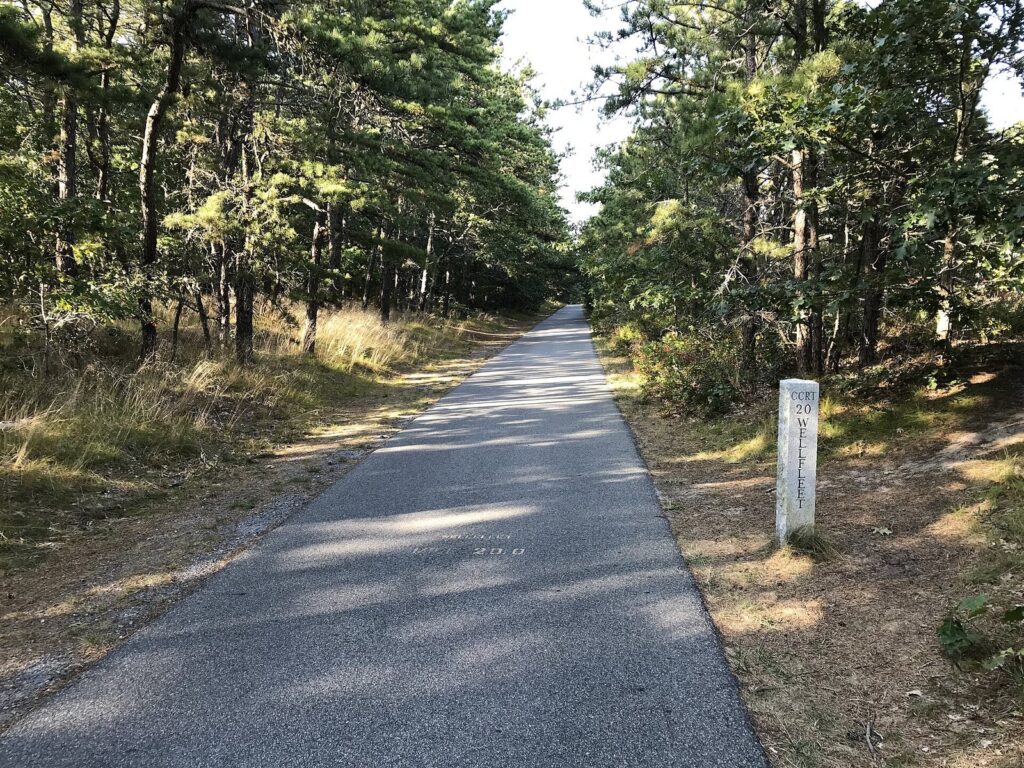
The Rail Trail is the Cape’s main bike route: a paved path of about 25 miles on an old railroad bed through Dennis, Harwich, Brewster, Orleans, Eastham and Wellfleet, with an extension west into South Yarmouth. It passes beach, salt marsh, pine forest and cranberry bog, and because it was built for trains, the grades are gentle all the way. The Park Service puts the Dennis-to-Wellfleet length at 26 miles, and signs and maps vary by a mile or so depending on where they start counting.
Rail Trail trailheads and parking
| Trailhead | Town | Why start here |
|---|---|---|
| Station Avenue | South Yarmouth | The western end of the extension; closest to the Mid-Cape |
| Route 134 | South Dennis | The traditional starting point for a full end-to-end ride |
| Headwaters Drive | Harwich | Near the Old Colony branch to Chatham |
| Route 137 | Brewster | A middle start for shorter family rides |
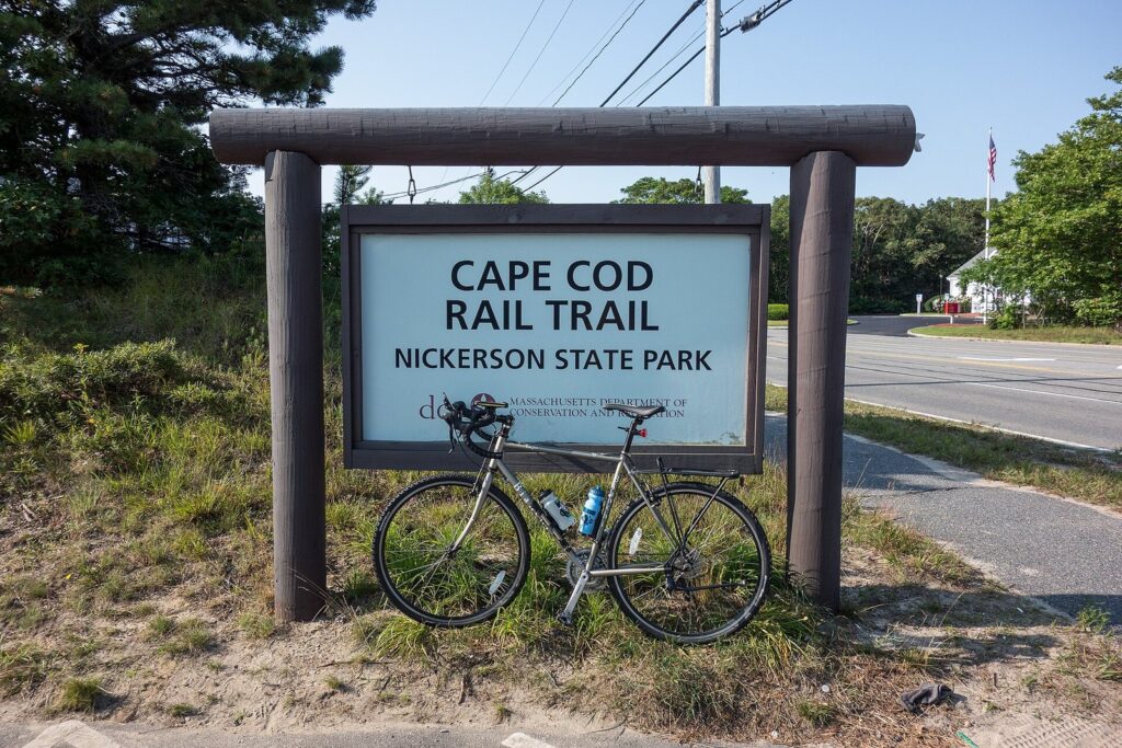
| Nickerson State Park | Brewster | Ponds, shade and the park’s own paths |
| Orleans Center | Orleans | Lunch and supplies in town |
| Salt Pond Visitor Center | Eastham | Links to the Nauset Bike Trail and Coast Guard Beach |
| LeCount Hollow Road | South Wellfleet | The northern end, near the Marconi area |
The Wellfleet lot on LeCount Hollow Road is long and narrow, and in summer overflow parking can make the marked spaces hard to reach, so it’s a better place to finish than to start on a July weekend. The Route 134 and Brewster lots are the usual choices for an early start.
Which section should you ride?
Each town’s stretch has its own character, which helps when you’re choosing where to join.
| Town | What you pass | Good for |
|---|---|---|
| Yarmouth and Dennis | The western trailheads at Station Avenue and Route 134 | Starting an end-to-end ride |
| Harwich | Woods, bogs and the junction with the Old Colony branch | Riding on to Chatham |
| Brewster | Nickerson State Park and its ponds | Families and swim stops |
| Orleans | The town center | Lunch and supplies |
| Eastham | Salt Pond Visitor Center and the start of the Nauset Bike Trail | The ride to Coast Guard Beach |
| Wellfleet | Pine woods, the Marconi area and the LeCount Hollow Road trailhead | A quiet northern finish |
You don’t have to do all of it, and most people don’t. Three sections cover most trips:
- Brewster and Nickerson State Park: the family favorite. Start at Nickerson or Route 137, ride a few miles in either direction, and swim in one of the park’s ponds afterward.
- Eastham to the ocean: start at Salt Pond Visitor Center and take the Seashore’s 1.6-mile Nauset Bike Trail to Coast Guard Beach. It’s the best short ride on the Cape because it ends at one of its best beaches.
- End to end: for fit riders, South Dennis to South Wellfleet and back is a solid 50-mile day. Arrange a pickup at the far end if you only want one direction.
Road crossings and etiquette
The trail is flat and paved, but it isn’t separated from the roads it meets. Expect frequent crossings, some of them busy summer roads. Stop, look both ways and walk your bike across the busy ones, because drivers don’t always stop even where they should. On the path itself, keep right, pass on the left, call out before you pass, and move off the pavement when you stop. On summer weekends the trail is busy with families, runners and rental bikes of every size, so leave the training-ride speed for early mornings or the off-season.
The Old Colony branch to Chatham
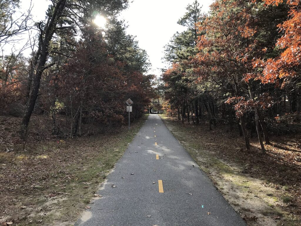
In Harwich, the Old Colony Rail Trail branches off toward Chatham, signed as the Chatham connector. It’s the way to reach Chatham by bike without riding Route 28, and it makes a good half-day out-and-back from the Harwich trailhead.
Bike rentals along the Rail Trail
You don’t need to bring a bike. Rental shops sit close to the trail, several with e-bikes, trailers and kids’ bikes. In 2026 they included Rail Trail Bike and Kayak in Brewster (with a Yarmouth location), On The Trail E-Bike Rentals in Brewster, Dennis Cycle Center, which delivers on multi-day rentals, and Idle Times Bike Shop, which rents e-bikes. Reserve ahead for summer weekends, and ask the shop which trailhead it’s closest to.
Shining Sea Bikeway: is it worth the ride to Woods Hole?
Yes. The Shining Sea Bikeway runs 10.7 miles from North Falmouth to Woods Hole, past Sippewissett Marsh, cranberry bogs and the Salt Pond Bird Sanctuary, and its southern miles run close to the water. It’s paved and flat, with fewer crowds than the Rail Trail, and it finishes in Woods Hole, a small harbor village with the ferries to Martha’s Vineyard and some good places to eat.
The path is named for a line of “America the Beautiful,” whose author, Katharine Lee Bates, was born in Falmouth. The northern start is on County Road in North Falmouth, where Bike Zone Rentals rents adult and kids’ bikes, tandems, trailers and tag-alongs; Art’s Bike Shop in North Falmouth also rents. If you’re staying in Falmouth village, join the path in the middle and ride to Woods Hole and back.
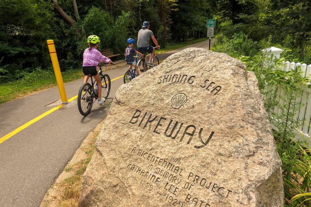
Verdict: the best bike route on the Upper Cape, and the better choice than the Rail Trail if you’re staying in Falmouth or catching a ferry. Think twice about riding to Woods Hole for a mid-morning ferry in summer: the village is busy with ferry traffic, so leave extra time to lock up and walk to the terminal.
Cape Cod Canal service roads: the easiest miles on the Cape?
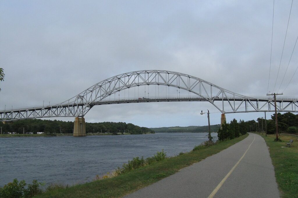
About 13.5 miles of paved service roads run along the two banks of the Cape Cod Canal, open to walkers, runners, skaters and cyclists and marked every half mile. The Army Corps of Engineers runs the canal, which is 17.5 miles long counting its approach channels, and its access areas along the main roads have parking, restrooms and picnic tables.
The riding is dead flat, the views take in the Bourne and Sagamore bridges and the railroad bridge, and there’s usually a tug, a fishing boat or a big ship moving through the canal. The catch is wind: the canal is exposed, and a breeze down its length can turn an easy ride into a workout on the way back. Ride into the wind first, while your legs are fresh. The canal is also the easy answer on arrival day, since it sits right by the bridges, and campers can stay close by at Bourne Scenic Park or Scusset Beach State Reservation.
What are the National Seashore bike trails like?
The Seashore has three paved bike trails, each short enough for a morning, and they share one rulebook.
| Trail | Town | Length | What to expect |
|---|---|---|---|
| Nauset | Eastham | 1.6 miles one way | From Salt Pond Visitor Center to Coast Guard Beach; joins the Rail Trail area at Salt Pond |
| Head of the Meadow | Truro | 2 miles, plus a 0.8-mile connector | Quiet riding near the ocean beaches of Truro |
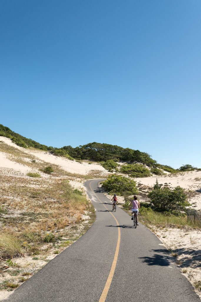
| Province Lands | Provincetown | 5.45-mile loop, plus spurs toward the beaches | Rolling hills and tight curves through the dunes; the most dramatic ride on the Cape |
The Province Lands loop is the one people remember. It climbs and dips through open dunes and beech woods between Herring Cove, Race Point and the Province Lands Visitor Center, which opens from May through October and has observation decks open all year. Strong kids love it; nervous riders should walk the steepest downhills.
Seashore bike rules
- Bikes are allowed on the three bike trails, paved roads and parking areas, and unpaved fire roads, but not on hiking trails or beaches.
- E-bikes are allowed wherever regular bikes are, but an e-bike ridden on the throttle alone, without pedaling, is limited to roads open to cars.
- Massachusetts requires everyone 16 and under to wear a helmet on a bicycle.
- Leashed dogs are allowed on the Head of the Meadow trail year-round, but on the Province Lands and Nauset trails only from November 1 to April 30.
- If you ride into a fee beach in season, the entrance fee is $15 per person on foot or by bike.
For everything else in the park, from beaches to lighthouses, see our Cape Cod National Seashore guide. In Provincetown, rental shops in 2026 included Arnold’s Bikes, renting since 1937, Ptown Bikes, Gale Force Bikes at the west end of town, and Provincetown Bike Rentals.
Can you ride off the pavement?
In a few places. The Seashore allows bikes on its unpaved fire roads as well as its paved trails and roads, which opens up some sandy, rooty riding for fat-tire and gravel bikes. Beaches, dunes and hiking trails stay off-limits. Elsewhere, conservation land rules vary by town, so check before you take a mountain bike onto a trail, and remember that soft sand stops narrow tires fast.
What do good Cape Cod ride days look like?
Four plans that work, from a short family morning to a car-free day at the tip of the Cape.
The Eastham ocean ride
Park at Salt Pond Visitor Center in Eastham, which is open daily year-round (9 a.m. to 4:30 p.m., until 5 p.m. in summer), and pick up a map. Take the Nauset Bike Trail 1.6 miles to Coast Guard Beach, lock up, and swim or walk the beach, then ride back and add a few miles of Rail Trail if legs allow. In season, Coast Guard Beach has no drop-off and drivers park at satellite lots and ride a shuttle, so arriving by bike is the easy way in, though the Seashore’s $15 per person fee for walkers and cyclists applies at its fee beaches in season.
The Falmouth ferry ride
Start on County Road in North Falmouth, ride the Shining Sea Bikeway 10.7 miles to Woods Hole, and have lunch by the harbor. Strong riders can take their bikes onto a Martha’s Vineyard ferry for the afternoon; everyone else rides back the way they came, which shows you the marsh and the water a second time from the other direction. Allow about three hours for the round trip with a lunch stop.
Provincetown without a car
Take the fast ferry with your bike from Boston (about 95 minutes; in 2026 it ran daily from May 16 to October 18, then weekends to November 15) or from Plymouth (90 minutes, leaving at 9 a.m. and back by 6 p.m. on the 2026 schedule), or rent a bike in town. From MacMillan Pier, ride through town to the Province Lands loop, climb to the visitor center’s observation deck, and drop down to Herring Cove for a swim before riding back to the boat. It’s one of the best car-free days in New England.
The canal arrival ride
Coming over the bridges on a summer Friday? Stop at a canal access area, ride the flat service road for an hour, and let the worst of the traffic thin out before you drive on. Ride into the wind first, and you’ll have it at your back when you’re tired.
Which Cape Cod hiking trails are worth your time?
Nobody comes to the Cape for elevation. The walks here are about texture: boardwalks through swamps, sand paths over dunes, and marsh edges full of birds. The Park Service lists 11 walking trails open year-round, and its 2026 visitor guide counts twelve, most of them under a mile and a half. Walks off the Seashore, at sanctuaries, refuges and town land, fill in the rest, and our guide to Cape Cod’s parks and nature areas explains who runs each one.
| Walk | Town | Length | Surface | Why go |
|---|---|---|---|---|
| Fort Hill | Eastham | 1-mile loop | Grass and dirt | The best marsh view on the Cape |
| Nauset Marsh | Eastham | 1.3-mile loop | Dirt and sand | Salt Pond and the marsh, from the visitor center |
| Red Maple Swamp | Eastham | 0.8 mile round trip | Boardwalk sections | Swamp woods, brilliant in fall |
| Buttonbush | Eastham | 0.3-mile loop | Boardwalk sections | Built for visitors with impaired sight |
| Doane | Eastham | 0.6-mile loop | Paved | Easy pine woods for wheels and small kids |
| Atlantic White Cedar Swamp | Wellfleet | 1.2-mile loop | Boardwalk and sand | A cedar swamp on a boardwalk |
| Great Island | Wellfleet | 3.9 to 8.8 miles round trip | Soft sand | The Cape’s big walk |
| Beech Forest | Provincetown | 1-mile loop | Dirt and sand | Ponds and beech woods in the dunes |
| Hatches Harbor | Provincetown | 3.3 miles out and back | Sand and marsh | A quieter walk to the edge of the Province Lands |
| Sandy Neck Marsh Trail | Barnstable | About 4.5 miles | Sand | Dunes and salt marsh, run by the town |
| Long Pasture | Barnstable | About 2.5 miles of trails | Woodland and meadow paths | Harbor views to Sandy Neck |
Surfaces in the table are general guides; trail conditions change after storms, so read the trailhead sign before you commit.
Great Island: the Cape’s big walk
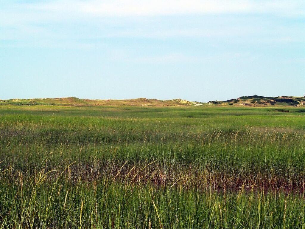
Great Island is the walk to plan for. Depending on how far you go, it’s 3.9 to 8.8 miles round trip, almost all of it in soft sand, and sand is the Cape’s stair-climber. The outer end can be cut off at high tide, so check a tide table, start early, carry plenty of water and sunscreen, and turn around sooner than your pride would like. Leashed dogs are allowed only on the first half mile.
Short walks with big payoffs
If you have an hour, go to Fort Hill in Eastham: a 1-mile loop over open meadow with a wide view of Nauset Marsh, and the Red Maple Swamp boardwalk starts nearby. The Atlantic White Cedar Swamp Trail in Wellfleet is the other short walk to put first if you’ve only seen the beaches, a 1.2-mile loop that drops from sand to a cool, dark boardwalk through the cedars. In Provincetown, the Beech Forest loop is a mile of ponds and trees in the middle of the dunes.
Longer walks off the Seashore
Sandy Neck in Barnstable has the best long walk off the Seashore: the Marsh Trail runs about 4.5 miles and the shoreline about 3.5, and you can loop them. Mass Audubon’s Wellfleet Bay sanctuary has about 5 miles of trails and a fully accessible All Persons Trail. At Monomoy National Wildlife Refuge, the Morris Island trails are open year-round from the lot at 30 Wikis Way in Chatham. And the canal’s service roads are as good for a long, flat walk as for a bike.
Which trails work best with kids?
Kids set the pace, and the best family routes are short, flat, off the road and end somewhere fun.
| Age | Ride | Walk |
|---|---|---|
| Under 5 | A trailer or child seat on the Shining Sea Bikeway or the canal | Buttonbush or the paved Doane loop |
| 5 to 8 | A short Rail Trail out-and-back from Nickerson State Park | Fort Hill, Beech Forest or the Wellfleet Bay sanctuary |
| 9 to 12 | The Nauset trail to Coast Guard Beach, or a longer Rail Trail section | Atlantic White Cedar Swamp or Morris Island |
| Teens | The Province Lands loop or the full Shining Sea Bikeway | Great Island or the Sandy Neck Marsh Trail |
A few things make family days easier. Helmets are the law for anyone 16 and under. Rental shops near the Rail Trail and the Shining Sea Bikeway have trailers, tag-alongs and kids’ bikes, so you don’t have to strap everything to the car. Plan the turnaround before anyone is tired, carry more water and snacks than seems reasonable, and finish at a pond or a beach. Our Cape Cod family vacation guide has more ideas, and our Cape Cod beaches guide covers the swims at the end.
How do you get your bike to Cape Cod and around it?
You can leave the car at home more easily than most people think.
- The CapeFLYER train from Boston carries bikes free in a dedicated bike car on its summer weekend runs.
- CCRTA buses carry up to three bikes each on their racks, and folding bikes can ride on board; motorized bikes aren’t allowed.
- The Provincetown ferries take bikes for a fee. In 2026 Bay State Cruise Company charged $10 one way or $20 round trip from Boston, plus a $5 fuel surcharge per leg, and Captain John Boats charged $15 from Plymouth. Ride off the boat at MacMillan Pier and you’re a short pedal from the Province Lands loop.
Our guide to getting to and around Cape Cod covers the train, buses and ferries in full, including schedules and seasons.
What are the rules and safety basics on Cape Cod trails?
Rules differ by landlord, and the signs at the trailhead are the final word. The basics that apply almost everywhere:
- E-bikes: the Seashore allows pedal-assisted e-bikes wherever bikes go. State and town paths set their own rules, so check the DCR or town page before you ride an e-bike on the Rail Trail or the Shining Sea Bikeway.
- Helmets: required by state law for riders 16 and under, and a good idea for everyone else on a busy summer path.
- Road crossings: the biggest risk on the rail trails. Stop, look, and walk across busy roads.
- Dogs: leashed, and only where allowed. On the Seashore that means a leash of 6 feet or less and a short list of trails; see the Seashore rules above.
- Ticks and poison ivy: both are common beside sandy and wooded trails. Stay in the middle of the path, and check everyone for ticks at the end of the day.
- Sun, water and sand: dune walks have no shade and soft sand doubles the effort. Carry water, and turn back early on hot days.
- Gear: carry a lock, water and a spare tube, or at least the rental shop’s phone number. Some rentals include a lock and helmet, so ask when you book.
- Closures: shorebird nesting closes some beach and dune areas from spring into summer, and storms can wash out sand trails. Posted signs mean it.
There’s no charge to ride the Rail Trail, the Shining Sea Bikeway or the canal service roads, and the Seashore’s trails are free. You pay only where a landlord charges for parking or beach entry, such as the Seashore’s fee beaches in season or Sandy Neck’s lot.
When is the best time to bike and hike on Cape Cod?
September and October are the best months: the air is cool, the paths are quieter, and the marshes and swamps turn gold and red. May and June are close behind, though ticks are active and some trails have nesting closures. July and August work if you start early, before the heat and the crowds; by late morning on a summer weekend, the busiest sections of the Rail Trail feel like a boardwalk.
Winter is underrated for walking. The Seashore’s trails stay open year-round, the woods open up once the leaves fall, and you may have Fort Hill to yourself. For more on the seasons, see our guide to the best time to visit Cape Cod, and check our Cape Cod events calendar for race weekends, which close roads around Falmouth in August and October. For a full day built around a ride, our Cape Cod itineraries include bike-friendly plans, and our Cape Cod food and drink guide covers the lunch stops.
Cape Cod Biking and Hiking FAQ
How long is the Cape Cod Rail Trail?
About 25 miles from South Dennis to South Wellfleet, through Dennis, Harwich, Brewster, Orleans, Eastham and Wellfleet; the Park Service rounds it to 26. An extension carries it west to Station Avenue in South Yarmouth, and the Old Colony Rail Trail branches off in Harwich toward Chatham. It’s paved and gently graded all the way.
Where do you park for the Cape Cod Rail Trail?
The main trailheads are Station Avenue in South Yarmouth, Route 134 in South Dennis, Headwaters Drive in Harwich, Route 137 in Brewster, Orleans Center and LeCount Hollow Road in South Wellfleet, with more access at Nickerson State Park and the Seashore’s Salt Pond Visitor Center. Arrive early on summer weekends.
Can you ride an e-bike on Cape Cod bike trails?
In the National Seashore, yes, wherever regular bikes are allowed, as long as you’re pedaling; throttle-only riding is limited to roads open to cars. State and town paths, including the Rail Trail and the Shining Sea Bikeway, set their own rules, so check the current DCR or town guidance before you ride.
What is the easiest bike path on Cape Cod for kids?
The canal service roads and the Shining Sea Bikeway are flat, paved and separated from traffic, and a short out-and-back on the Rail Trail from Nickerson State Park is a classic first ride. Everyone 16 and under must wear a helmet, and rental shops near the trails have trailers and kids’ bikes.
What is the best hike on Cape Cod?
For a big day, Great Island in Wellfleet: 3.9 to 8.8 miles round trip in soft sand, timed around the tide. For a short walk with the biggest payoff, Fort Hill and the Nauset Marsh Trail in Eastham. For a swamp you won’t forget, the Atlantic White Cedar Swamp boardwalk in Wellfleet.
Are there hills on Cape Cod bike trails?
Very few. The Rail Trail follows an old railroad bed with gentle grades, and the canal service roads and the Shining Sea Bikeway are close to flat. The exception is the Seashore’s Province Lands loop in Provincetown, which rolls through the dunes with short, steep climbs and tight downhill curves. On most days the wind matters more than the hills.
Can you bring a bike on the ferry to Provincetown?
Yes, for a fee. In 2026 Bay State Cruise Company charged $10 one way or $20 round trip from Boston, plus a $5 fuel surcharge per leg, and Captain John Boats charged $15 from Plymouth. From MacMillan Pier it’s a short ride through town to the Province Lands Bike Trail.
Related Cape Cod Guides
- Cape Cod National Seashore: beaches, trails, lighthouses and fees in the Cape’s biggest park
- Cape Cod Parks and Nature: state parks, refuges, sanctuaries and where to camp
- Getting to and Around Cape Cod: bikes on trains, buses and ferries
- Cape Cod Family Vacations: easy rides, short walks and beaches for kids
- Cape Cod Itineraries and Day Trips: day plans with a ride or a walk built in
- Where to Stay on Cape Cod: towns and lodging near the bike paths
Sources and verification
Trail lengths, trailheads, rules, fees and rental listings were checked on September 23, 2026 against the agencies, operators and businesses listed below. This guide is compiled from those sources and does not claim first-hand visits.
- Massachusetts DCR: Cape Cod Rail Trail
- National Park Service: biking at Cape Cod National Seashore
- National Park Service: guide to Seashore trails
- National Park Service: 2026 Cape Cod National Seashore visitor guide (PDF)
- U.S. Army Corps of Engineers: Cape Cod Canal recreation
- Cape Cod Commission: bicycle and pedestrian planning
- Town of Falmouth
- Town of Barnstable: Sandy Neck Beach Park
- Mass Audubon: Wellfleet Bay Wildlife Sanctuary
- U.S. Fish and Wildlife Service: Monomoy National Wildlife Refuge
- CapeFLYER
- Cape Cod Regional Transit Authority
- Bay State Cruise Company
- Captain John Boats
- Rail Trail Bike and Kayak
- Arnold’s Bikes, Provincetown
Cape Cod Tourism Guide is an independent publication, not affiliated with the Cape Cod Chamber of Commerce, the National Park Service or any business named here.
Photo credits
- Cape Cod Canal bike path, Bourne: photo by John Phelan, Wikimedia Commons (CC BY 3.0)
- Cape Cod Rail Trail, South Wellfleet: photo by John Phelan, Wikimedia Commons (CC BY-SA 4.0)
- Rail Trail sign at Nickerson State Park: photo by Kenneth C. Zirkel, Wikimedia Commons (CC BY-SA 4.0)
- Old Colony Rail Trail, Harwich: photo by John Phelan, Wikimedia Commons (CC BY-SA 4.0)
- Shining Sea Bikeway marker, Falmouth: photo by Kenneth C. Zirkel, Wikimedia Commons (CC BY-SA 4.0)
- Province Lands Bike Trail: photo by Giorgio Galeotti, Wikimedia Commons (CC BY 4.0)
- Walk to Great Island, Wellfleet: photo by takomabibelot, Wikimedia Commons (CC BY 2.0)